
|
Facility Name
|
Year Constructed | Curb? | Steeplechase information |
|
Cross streets or directions
Notes on unique situations and security problems Credited Manufacturer or installer Type of Surface |
Finish direction "Imperial" if track is measured in yards. | Number of lanes
Straightaway length
|
Aerial photo link courtesy of Mapquest Altitude |

Fallon |
| Churchill High School | 1995 | No | No |
|
Taylor and Front
These Northern Nevada aerial photos are very hard to read--this looks like dirt. Southwestern Seal Flex |
East West |
8
|
Black & White Aerial photo |
Boulder City |
| Boulder City High School | 1998 | No | No |

6th and Avenue B
Black Southwestern Seal Flex |
South |
8
|
Aerial photo |
Henderson |
| Basic High School | 1998 | No | No |
|
Palo Verde and Dooley
Black Southwestern Seal Flex |
South |
8
|
Aerial photo |
| Coronado High School | 2000 | No | No |
|
Coronado Center, South of Eastern and
St. Rose
Black. Wide turns Southwestern Seal Flex |
North |
8
85m
|
Aerial photo of location |
| Green Valley High School | Resurf. 1998 |
No | No |
|
Arroyo Grande between Sunset and Warm
Springs
Black. Originally installed in 1990 Southwestern Seal Flex |
West |
8
|
Aerial photo |
| Foothill High School | No | No | |

College at the 515 Freeway exit
Black. Wide Turns Southwestern Seal Flex |
South |
8
85m
|
Aerial photo |
| Liberty High School | 2005 | No | No |
|
Bermuda and Liberty Heights This is so far out I had to take dirt roads to get there. It will be urbanized by 2006 Black. Wide Turns Southwestern Seal Flex |
South | 8
80m
|
Aerial photo |
Indian Springs |
| Indian Springs High School | 1998 | No | No |
|
Southwestern Seal Flex
|
8
|
Las Vegas |
| Arbor View High School | 2006 | No | No |
| Buffalo and Grand Teton,
far north end of town Wide Turns. This new track is actually standard track Orange I believe this is the first fake grass infield in Las Vegas, with the long jump runways only on the east side, the turf shifted off center to the west. Southwestern Seal Flex |
South | 8
80m
|
Aerial photo |
| Bonanza High School | 1998 | No | No |
|
Torrey Pines and Oakey
Black Southwestern Seal Flex |
South |
8
|
Aerial photo |
| Centennial High School | 2004 | No | No |
|
way West on Centennial Parkway in the
far north end of what will be town
Black Southwestern Seal Flex |
South |
8
|
Aerial photo |
| Chaparall High School | 1998 | No | No |
| Twain at the 515 underpass Black. Broken back track with 113 m straightaway Southwestern Seal Flex |
South | 8
113m
|
Aerial photo |
| Cimmaron Memorial High School | Resurf. 1998 |
No | No |
| Tenaya North of Lake Mead Black. Originally installed in 1990 Southwestern Seal Flex |
North | 8 |
Aerial photo |
| Clark High School | 1998 | No | No |
|
Wynn and Sirius
Black. Broken back track with 113 m straightaway Southwestern Seal Flex |
South |
8
113m
|
Aerial photo |
| Cimmaron Memorial High School | Resurf. 1998 |
No | No |
| Tenaya North of Lake Mead Black. Originally installed in 1990 Southwestern Seal Flex |
North | 8 |
Aerial photo |
| Del Sol High School | 2005 | No | No |
|
Patrick Lane between Pecos and Eastern
(off the end of the LAS runway)
Black Wide Turns Southwestern Seal Flex |
South |
8
80m
|
Aerial photo |
| Durango High School | Resurf. 1999 |
No | No |
|
Dewey west of Rainbow
Black. Originally installed in 1992 Southwestern Seal Flex |
South |
8
|
Aerial photo |
| El Dorado High School | Resurf. 1999 |
No | No |
|
Harris and Christy
Black. Originally installed in 1990 Southwestern Seal Flex |
South |
8
|
Aerial photo |
| Faith Lutheran High School | 1999 | No | No |
|
Hualapai north of Charleston--far west
end of Las Vegas as Charleston goes out of town
Black. A private school with a track. Inside concrete curb elevates the track. Southwestern Seal Flex |
South |
8
101m
|
Aerial photo |
| Las Vegas High School | No | No | |
|
Sahara and Hollywood--the far east end
of Sahara
Black. Wide Turns Southwestern Seal Flex |
South |
8
85m
|
Aerial photo |
| The Meadows School | No | No | |

N. Rampart Blvd. opposite Hillpointe
Rd. just north of Summerlin Parkway
Black. Another private school with a track. Here the lane lines alternate colors between blue and white. Southwestern Seal Flex |
South |
8
80m
|
Aerial photo |
| Palo Verde High School | 1997 | No | No |

Pavilion Center and Alta--far west side
Black. I have never seen this place when it isn't windy Southwestern Seal Flex |
South |
8
100m
|
Aerial photo |
| Rancho High School | 1998 | No | No |
21st and Searlies
Black. Broken back track with 113 m straightaway Southwestern Seal Flex |
South |
8
113m
|
Aerial photo |
| Shadow Ridge High School | 2003 | No | No |
|
Brett and Thom, 1 mile east of Jones.
Northwestern area. This is at the (current) far north end of town. Decent night lighting. Black. Wide Turns Southwestern Seal Flex |
South |
8
79m
|
Aerial photo of construction |
| Silverado High School | 1999 | No | No |

SW Corner of 215 and Spencer
Black. Wide Turns Southwestern Seal Flex |
South |
8
85m
|
Aerial photo |
| Sierra Vista High School | 2001 | No | No |
|
Robindale--currently a high school in
the middle of nowhere, surrounded by desert.
Southwestern area. The way Las Vegas grows, this will be the center of town in a couple of years. With Black. Wide Turns Southwestern Seal Flex |
South |
8
85m
|
Aerial photo of construction |
| University of Nevada, Las Vegas | 1998 | Yes | Yes, inside |
 Swenson
and Harmon, a block from the Hard Rock Hotel Swenson
and Harmon, a block from the Hard Rock HotelFor tourists, this is the closest to "The Strip." They moved the track about 200 yards southeast of its original location (toward the nearby Hardrock Casino). This is the only track in town that is fenced and locked during the evening hours when it is most practical to run. I've noticed many (I assume to be locals) just jump the fence. UNLV only has a Women's track team (Title IX). Southwestern Martin ISS |
South |
9
84m
|
Aerial photo |
| Valley High School | 1998 | No | No |

Karen and Eastern
Black Southwestern Seal Flex |
East |
8
|
Aerial photo |
| Western High School | 1998 | No | No |
|
Bonanza and Decatur--north of the Decatur
exit off the 93
Broken back track with 113 m straightaway Southwestern Seal Flex |
South |
8
113m
|
Aerial photo |
Laughlin |
| Laughlin High School | 1999 | No | No |
|
Cougar Drive and Spirit Lane
Black. Up the hill out of town. This is way out of town in the middle of the desert. But then the whole town is a little spot of casinos along the river in the desert. Southwestern Seal Flex |
South |
8
|
Aerial photo |
Logandale |
| Moapa Valley High School | Resurf. 1999 |
No | No |
|
Originally installed in 1992
Black Southwestern Seal Flex |
South |
8
|
Mesquite |
| Virgin Valley High School | Resurf. 1999 |
No | No |
|
Originally installed in 1990
Southwestern Seal Flex |
South |
8
|
North Las Vegas |
| Canyon Springs High School | 2006 | No | No |
| Alexander and 5th south
of W. Craig Wide Turns This new track is actually standard track Orange Southwestern Seal Flex |
South | 8
80m
|
Aerial photo |
| Cheyenne High School | Resurf. 1998 |
No | No |
|
Harris and Christy
Black. Originally installed in 1990 Southwestern Seal Flex |
South |
8
|
Aerial photo |
| Community College of Southern Nevada | No | No | |
|
Colton and Pecos
Black. Lit frequently at night Southwestern Seal Flex |
South |
8
|
Aerial photo |
| Mojave High School | 1997 | No | No |
|
N. 5th and E. Washburn
Black. Originally installed in 1990 Wide Turns Southwestern Seal Flex |
South |
8
|
Aerial photo |
Carson City |
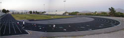
| Carson City High School | 1992 | Yes | No |

Black with a concrete curb
Southwestern Seal Flex |
9
|
Aerial photo |
Elko |
| Elko High School | Resurf. 2003 |
No | No |
|
Originall built in 1996
Southwestern Seal Flex |
|
Map |
Yerington |
| Yerrington High School | No | No | |
|
Pearl and Oregon St (1 block east of
95 and Main St.)
Photo looks like a dirt track? Southwestern Seal Flex |
South |
8
|
Black & White Aerial photo |
Reno |
| Reno High School | No | No | |
|
Idlewilde Dr. and Hunter Lake Dr..
Southwestern Eurotan |
|
Bad Black & White Aerial photo |
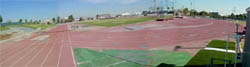
| University of Nevada | 1989 | Yes | Yes, inside |
|
15th Street and N. Virginia St.
The photo is so hard to read I can't tell if this is the track. They have reportedly also installed a fake grass infield. Southwestern Eurotan |
|
Bad Black & White Aerial photo |
Sparks |
| Reed High School | No | No | |
|
Sparks Blvd. and Baring Blvd.
|
South |
|
Bad Black & White Aerial photo |
| Sparks High School | No | No | |
|
15th Street and Oddie Blvd.
Southwestern Eurotan |
|
Bad Black & White Aerial photo |