
|
Facility Name
|
Year Constructed | Curb? | Steeplechase information |
Cross streets or directions
|
Finish direction (as you face crossing the finish line) |
Number of lanes
Straightaway length
|
Aerial photo link courtesy of Google Maps
Altitude |

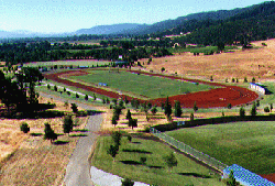
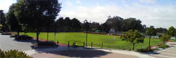
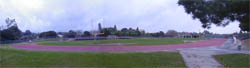
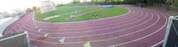
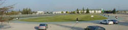
Alameda |
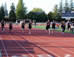
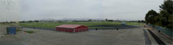
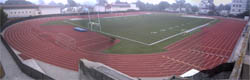
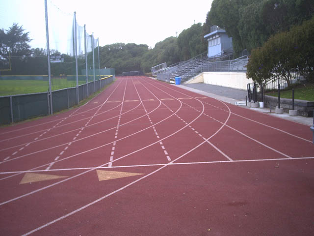
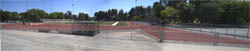
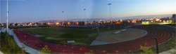
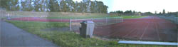
| College of Alameda | 2003 | No | No |
 Tinker Ave. West of Mariner Square Loop
just west of the tube
Tinker Ave. West of Mariner Square Loop
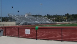
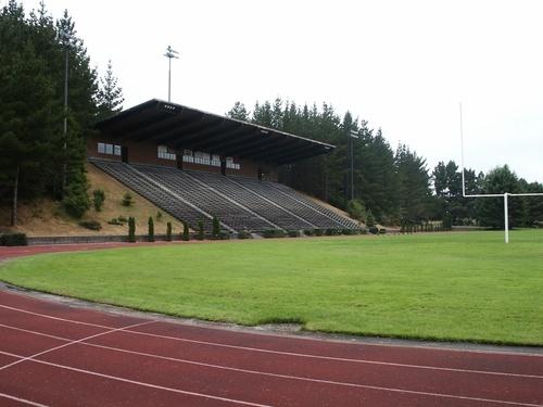
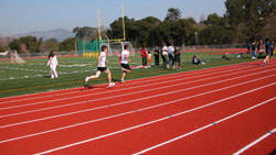
just west of the tubeRecently resurfaced in Mondo. I'm going to rant here: This one pisses me off. I have gotten mail from a high school less than a mile from this track seeking information about building an irregular sized all-weather track for the team to practice on. This first class track is an unused buffer for the soccer field, locked behind high security fencing. There is no team at this school, the only users of the track are a flock of geese, who have left a layer of their byproducts all over the track. The school apparently doesn't even bother to clean it. Other than the High Jump pad, no field event facilities were installed. Mondo |
North |
8
90m
|
Aerial photo |
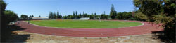
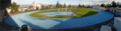
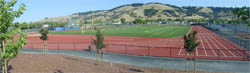
Berkeley |
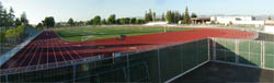
| Berkeley High School | 1994 | Yes metal |
No |
 Martin Luther King and Channing Way
Southwestern Eurotan |
South |
6
92m
|
Aerial photo |
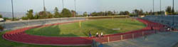
| St. Mary's High School | 1970's | No | No |
 Posen Ave. and Monterey
Ave. Posen Ave. and Monterey
Ave. A triangular track surrounding the football and baseball fields. 7 lanes on sprint straight. Straightaways are (estimated) 77m, 75m and 45m. Lots of cracks and pocked with repairs. |
West, Imperial | 6
77m
|
Aerial photo |
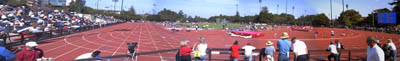
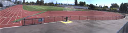
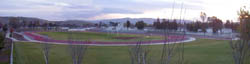
| University of California, Berkeley Edwards Stadium | Resurf. 1999 |
Yes metal |
Adjustable |
 Bancroft
and Oxford Bancroft
and OxfordYellow. There is a warm up lane inside of the curb. This has to be the ugliest color I have ever seen on a track (I guess they were trying for Gold, as in Golden Bears), with blue lines. But my opinion could be wrong, this was awarded as an Outstanding Track Facility by the USTC&TBA, an industry association. ! At night, this is effectively closed with gates and concrete walls. See Facility Website Southwestern Martin ISS |
South |
8
92m
|
Aerial photo |
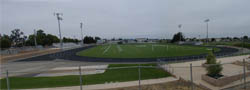
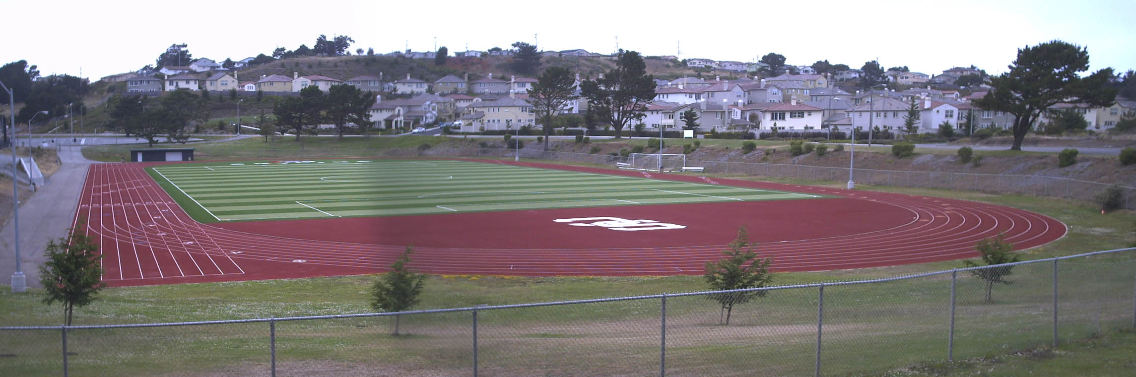
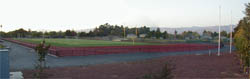
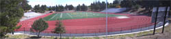
Castro Valley |
| Castro Valley High School | 2007 | No | No |
 Redwood Road and Heyer
Ave. Redwood Road and Heyer
Ave. |
South | m
|
Aerial photo |
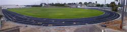
Emeryville |
| Emery High School | 1999 | No | No |
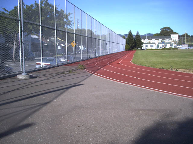 San Pablo Ave. and 53rd
St. San Pablo Ave. and 53rd
St.You have got to see the shape of this one. This is an all weather track with a right turn and an angled straight in it, I kid you not--see the aerial photo. This is apparently not a 400 meter track from the looks of it, how would they measure with a right turn? Road course rules? Now that I have gotten to see it in person, there are no calibrated start lines, just a start and finish line (apparently for 100M) on the longest straightaway. Those lines are slightly into the turns so the straightaway is 99m with no run out and a sharp turn at the end! There is also a noticible change in elevation and drainage slopes along this track. This has the highest fence I have seen yet. This whole, microscopic high school campus (this is the smallest urban campus I've seen) is not easy to get into. Is this a jail? The AW long jump runway and pit are full of weeds (indicating no maintenence or usage) and the high jump pad is not much more useful than a postage stamp. Southwestern Eurotan |
West |
4
99m
|
Aerial photo |
Fremont |


|
Washington High School
|
No | ||
 Country Drive and Lexington Street, 1 block north of Fremont Blvd. Country Drive and Lexington Street, 1 block north of Fremont Blvd.Called Tak Fudenna Memorial Stadium, used as a stadium for the entire Fremont School District. See Stadium Website |
South |
8 m
|
Aerial photo |
Hayward see also Union City |
|
California State University, East Bay
|
early 1970's | (Yes but) | Stationary, Inside, slice |
 Between Hayward Blvd and Harder Rd. East
of Mission Blvd. Between Hayward Blvd and Harder Rd. East
of Mission Blvd.The track at this location dates to the 1970's, but was not upgraded since its original installation (before 1973 when I first saw it) until the latest major renewal. And in a wimpy step of geopolitical ambiguity, the name of Cal State Hayward has been replaced with "East Bay." |
North |
8 99m
|
Aerial photo |
|
Chabot Junior College
|
Resurf 2001 | (No) | Adjustable, Inside |
 25555 Hesperian Blvd. North Entrance
North of the 92 Freeway
25555 Hesperian Blvd. North Entrance
North of the 92 FreewayThey have the curbing and the inner line has been drilled to mount it, but it has been removed and is sitting along the fence outside of the track--and it looks like its been there a while. Perhaps they put it in place when a meet is important but I have seen them conduct meets without a curb. Steeplechase finishes the opposite direction. Cal Track Premier Polyurethane |
South |
9
99m
|
Aerial photo |
Livermore |
|
Granada High School
|
2002 | No | No |
Wall St. south of Stanley Blvd.
A new fake grass infield and lots of renovations were added in 2007--I don't know if that includes a resurfacing. There is a strange crack sealed in lane 1 of the home stretch. Spectra Turf Spectratrack SP |
South |
9
95m
|
Aerial photo |
|
Livermore Valley High School
|
1999 | No | No |
4th and School St. near
Maple Street and East Ave.
Southwestern Eurotan |
North | Aerial photo |
Newark |
|
Newark Memorial High School
|
Resurf. 1998 |
No | No |
 Cedar
Blvd. off Central Ave. Cedar
Blvd. off Central Ave.! This is a security fortress, difficult, but not impossible to get into. Note: the unattended sprinkler system and bad drainage has done more damage to the track than any runner. I'll note yet again when I visited, the sprinklers were running and flooding the entire track like they apparently (from the water stains) have been for years. The wall in background of the picture is a dominant feature on the northeast end of the track. Southwestern Eurotan |
Northeast |
8
90.5m
|
Aerial photo |
Oakland |
|
Castlemont High School
|
2003 |
No | |
 MacArthur Blvd. south of 82nd Ave.
It might be easier to get in from Bancroft on 84th or 85th Ave. With a new fake grass infield Southwestern |
|
Aerial photo |
|
Laney Community College
|
April 2003 | (No) | Adustable, Inside |
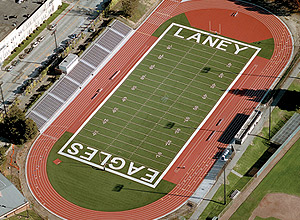 5th Ave. between E. 8th Street and E
10th St.
5th Ave. between E. 8th Street and E
10th St.Mondo |
Northwest |
8
|
Aerial photo |
|
Merritt Community College
|
February 2003 |
Yes metal |
Yes, Inside |
 East end of the campus, off Campus Drive
which is off Redwood Road between the 13 and Skyline.
East end of the campus, off Campus Drive
which is off Redwood Road between the 13 and Skyline.Mondo |
South |
8
88m
|
Aerial photo |
|
McClymonds High School
|
2001 | No | No |
 28th Street and Chestnut 28th Street and Chestnut370 meters with calibrated lines for each distance and each relay hand off zone. Every line seems correct except for an unexplainable blue line (at least that I cannot figure out) equivalent with the acceleration zone of the 3rd 4x100 handoff. I can't explain how the 4x400 (1600m) relay start line, in lane 1 is 9" shorter than the 1600 start line that has to be at the same location. ! located in a run down neighborhood at a run down looking inner city high school, this very clean track is kept secure not only by a fence with slats but one they have placed a fine mesh screen over each chain link gate to make it harder to climb. Jim
Hines |
South non-standard |
6 |
Aerial photo |
|
Oakland Technical High School
|
2001 | No | No |
42nd Street and Broadway
Reportedly 380 meters, from the same source that originally told me of McClymonds above. From the angle I could see, it is definitely a short track, but I didn't analyze the specifics. I must appologize but I just didn't fight my way into this one too. ! Tall fencing surrounds the school. This is in the center of the campus. |
East non-standard |
6 |
Aerial photo |
|
Skyline High School
|
2003 |
No | |
 MacArthur Blvd. south of 82nd Ave. MacArthur Blvd. south of 82nd Ave.With a new fake grass infield Southwestern |
|
Aerial photo |
Piedmont |
|
Piedmont High School
|
No | No | |
 End
of El Cerrito Ave., south of Oakland Ave. End
of El Cerrito Ave., south of Oakland Ave. |
Northwest |
7
87m
|
Aerial photo |
Pleasanton |
| Amador Valley High School | 2002 | Yes | No |
Surrounding a Fake Grass infield. Finish line offset 10m. |
North |
8 |
Aerial photo |
| Foothill High School | 2003 | Yes | No |
 Foothill Road and Muirwood Dr.
 |
South |
8
97m
|
Aerial photo |
Union City |
|
James Logan High School
|
1996 | Yes Metal |
No |
1800 H Street, north of Alverado-Niles
This looks like a fake grass infield. ! I'm told this is not open to the public Southwestern |
South | 8 |
Aerial photo |
Antioch |
| Deer Valley High School | No | No | |
Deer Valley Road and Lone Tree Way
Black |
South |
6
|
Aerial photo |
Bay Point (also known as West Pittsburg) |
| Riverview Middle School | No | No | |
 Pacifica Avenue and Inlet Drive
Track is on the south of the campus, by the river. |
North | 8 |
Aerial photo |
Brentwood |
| Liberty High School | 2005 | No | No |
 Spruce St. and Shasta Daisy Dr.
The distinctive feature of this track is the stone/concrete retaining wall below the stands. |
Southeast | 9 |
Aerial photo |
Concord |
| Clayton Valley High School | 2005 | No | No |
 Academy Road and Alberta Way
Surrounding a fake grass infield Blue |
West | 8
94m |
Aerial photo |
| De La Salle High School | 1999 | No | No |
Treat Blvd. and Winton Drive |
West | Aerial photo |
| Ygnacio Valley High School | No | No | |
 Oak Grove Road south of Treat Blvd.
Just over the fence from De La Salle Surrounding a fake grass infield |
Northwest | 8
m |
Aerial photo |
Danville |
| Monte Vista High School | No | No | |
 Stone Valley Road west
of Green Valley Rd. Stone Valley Road west
of Green Valley Rd.Fake Grass infield. |
South | 8
102m
|
Aerial photo |
| San Ramon Valley High School | No | No | |
 Front of the school is
on Love Lane, just south of Danville Blvd. and Railroad Ave., the track
is way in the back of the school off of DelAmigo Road Front of the school is
on Love Lane, just south of Danville Blvd. and Railroad Ave., the track
is way in the back of the school off of DelAmigo RoadLong Straightaways, Fake Grass infield |
Southeast | 8
106m
|
Aerial photo |
Hercules |
| Hercules Middle High School | Old | No | No |
| Refugio Valley Road west
of Redwood Rd. Black |
East | 8
100m |
Aerial photo |
Lafayette |
| Acalanes High School | Dec 2003 |
No | No |
 Pleasant Hill Road and Stanley Blvd.
|
South | 6 |
Aerial photo |
Martinez |
| Alhambra High School | Resurf. 1999 |
Yes | No |
 E St. west of Alhambra Ave. This is
up the hill, way behind the school.
E St. west of Alhambra Ave. This is
up the hill, way behind the school.Southwestern |
South |
9
100m
|
Aerial photo |
| Martinez Middle High School | Old | No | No |
| Court Street, south of Susana
Street An undersized mini-track at the middle school. Black probably paved. |
West | 6
|
Aerial photo |
Moraga |
| Campolindo High School | Resurf. 1997,2005 |
Yes concrete |
No |
 Campolindo Dr. and Moraga Rd.
 Black |
East | 8 |
Aerial photo |
Orinda |
| Miramonte High School | 1996 | No | No |
 Estabueno Dr. and Moraga Way
|
Southeast |
6
|
Aerial photo |
Pinole |
| Pinole Valley High School | 2005 |
No | No |
| East |
8
100m |
Aerial photo |
Pittsburg see also Bay Point |
| Pittsburg High School | Resurf.
1998 |
No | No |
 Railroad Ave. and School Street, north
of Hwy. 4 Railroad Ave. and School Street, north
of Hwy. 4Southwestern Eurotan |
Northwest |
6
|
Aerial photo |
Pleasant Hill |
| College Park High School | June
2001 |
No | No |
 Viking Dr. and Norse Dr. Just south
of Diablo Valley College
Viking Dr. and Norse Dr. Just south
of Diablo Valley CollegeCal Track Cal Trax IMS |
South |
9 |
Aerial photo |
| Diablo Valley College | Resurf. 1998 | Yes | Yes, outside |
 Golf Club Rd. west of Contra Costa Blvd.
An AW track has been here since the 1970's This surrounds an old Astroturf field. Southwestern Eurotan |
South |
9 |
Aerial photo |
Richmond |
| Kennedy High School | No | No | |
Cutting Blvd. and Berk Avenue opposite S. 41st Street |
South | 8
91m |
Aerial photo |
| Richmond High School | No | No | |
 Emeric Avenue and 26th Street
Surrounding a fake grass infield |
South | 8
85m |
Aerial photo |
| Salesian High School | 2008 | No | No |
At the end of Howard Street west of 29th Street |
North | 8
91m |
Aerial photo |
San Pablo |
| Contra Costa Community College | 1998 | Yes | Yes, Outside |
 Mission Bell Dr. and El Portal (Broadway
South)
Mission Bell Dr. and El Portal (Broadway
South)Southwestern Eurotan |
Northeast |
8
93m
|
Aerial photo |
San Ramon |
| California High School | 2001 | No | No |
 Broadmore Dr. and Riviera Way, south
of Montevideo Broadmore Dr. and Riviera Way, south
of Montevideo Finish line offset 10m. 9 lanes on the sprint straight. Now with a new Fake Grass Infield Southwestern |
South |
8
100m |
Aerial photo |
| Dougherty Valley High School | 2007 | No | No |
 Bollinger Canyon Road and
Albion Road Bollinger Canyon Road and
Albion RoadSurroinding a Fake Grass infield. From the pictures I have seen, it looks to be on a hill overlooking a newly constructed valley. |
8
100m
|
Aerial photo |
Walnut Creek |
| Las Lomas High School | No | No | |
 Broadway south of Newell
Ave. just off the 680 Broadway south of Newell
Ave. just off the 680Adjacent to the creek. 8 lanes on the sprint straight.  Dave Weill Dave Weill |
South | 6
93m
|
Aerial photo |
Crescent City |
| Del Norte High School | Redone 2002 |
No | No |
El Dorado St. and W. Washington
Blvd.
Rubber Asphalt has been here since 1982 Looks like the finish line is offset 10 m Cal Tracks Cal Trax IMS Blue |
East |
8
|
Aerial Photo |
Hoopa |
| College of the Redwoods | Old | No | No |
Loop Road at Highway 96 |
Southeast |
8 |
Aerial Photo |
Arcata |
| California State University, Humboldt | Resurf. 2001 | No | Yes |
 East Laurel Dr.
Called the Redwood Bowl this track has large covered stands |
North |
6
|
Aerial Photo |
Bayside |
| Jacoby Creek School | 2000 | No | |
A short, rectangular elementary school track with the numbers marked backward. Ocean Marker Sports Surfaces |
South |
3 |
Aerial Photo |
Eureka |
| College of the Redwoods | No | ||
 7351 Tomkins Hill Road (7 miles south
of town) 7351 Tomkins Hill Road (7 miles south
of town)Notice the covered stands and a start line in the turn, probably indicating it is an Imperial track |
East |
8 |
Aerial Photo |
| Eureka High School | Old | No | No |
Del Norte Street between K and N
Rubber Asphalt |
South |
8 |
Aerial Photo |
Fortuna |
| Fortuna High School | 1998 | No | No |
14th Street South of K St.
Finish line offset over 20m. Southwestern Seal Flex |
East |
|
Aerial Photo |
McKinleyville |
| McKinleyville High School | No | No | |
 Murray Road and McKinleyville
Ave . Murray Road and McKinleyville
Ave .Finish line offset over 10m. |
West |
|
Aerial Photo |
Trinidad |
| Trinidad Union Elementary School | 2005 | No | No |
Stagecoach Road and State
Park Road An asymetrical, rectangular narrow track around the play field. |
2 |
Aerial Photo |
Kentfield |
| College of Marin | No |
No | |
 College
Ave. opposite Woodland Rd. South of Sir Francis Drake Blvd. College
Ave. opposite Woodland Rd. South of Sir Francis Drake Blvd. Finish line offset 20m, sprints marked backward on the home stretch. |
North |
8
|
Aerial photo |
Larkspur |
| Redwood High School | 200 | No | No |
 Doherty Dr. and Riviera Circle
 |
East | 8
100m
|
Aerial photo |
Novato |
| Novato High School | 2005 |
No |
No |
 Arthur St. and Washington
St. Arthur St. and Washington
St. With a Fake Grass infield |
Northeast |
8
100m |
Aerial photo |
| San Marin High School | 2005 |
Yes |
No |
 San Marin Drive North of
Novato Blvd.. San Marin Drive North of
Novato Blvd.. With a Fake Grass infield and a curb. |
South | 8
99m |
Aerial photo |
San Anselmo |
| Sir Francis Drake High School | No |
No | |
 College
Ave. opposite Woodland Rd. South of Sir Francis Drake Blvd. College
Ave. opposite Woodland Rd. South of Sir Francis Drake Blvd. Surrounding a Fake Grass Infield with a live tree in the south D sector |
South | 8 |
Aerial photo |
San Rafael |
| San Rafael High School | 2001 | No | No |
 3rd St. at Embarcadero Way, or 185 Mission Ave. at Belle
Ave.
3rd St. at Embarcadero Way, or 185 Mission Ave. at Belle
Ave.Lane 8 appears to be built very close to the fence Ocean Marker Sports Surfaces |
South |
8
100m
|
Aerial photo |
Ukiah |
| Mendocino College | Yes inside | ||
 Hensley Creek Road West
of 101
Steeplechase finishes on backstretch. |
Northwest |
8
100m
|
Aerial Photo |
Carmel |
| Carmel High School | resurfaced 2002 |
No | No |
 Ocean Ave. at Highway 1 Ocean Ave. at Highway 1 No longer Black it has been recently resurfaced (you can see the different time elapse on the Google aerial). The curb slightly raises the track. |
West |
6
99m
|
Aerial photo |
Chualar |
| Chualar School | 2002 | No | No |
 Lincoln St. and Payson St./Chualar Rd
(changes name at Lincoln St., the east edge of town)
Lincoln St. and Payson St./Chualar Rd
(changes name at Lincoln St., the east edge of town)Square 4 lane track around a well groomed soccer field in this very small farm town. About 250m. The only calibrated lines are a finish line, a 50m? scratch line and a 100m staggered start for 1/4 turn. Manufacturer sprayed logo onto the track. Spectra Turf Spectratrack ISP |
East Non-standard |
4
73m
|
Aerial Photo |
Greenfield |
| Greenfield High School | 2006 | No | No |
 Forest
Lake Rd. and Viscaino Rd. Forest
Lake Rd. and Viscaino Rd. Wide turns Black |
West |
8
85m
|
Aerial photo |
King City |
| King City High School | 2006 | No | No |
 Forest Lake Rd. and Viscaino
Rd. Forest Lake Rd. and Viscaino
Rd. In one step this small town school has advanced itself forward with a new All Weather track and took a giant step backward by building it to imperial distances that haven't been used in 30 years. Finish line offset 10m. Blue United Sports Surfaces |
West, |
9
100m
|
Aerial photo |
Monterey |
| California State University, Monterey County (Old Fort Ord) | Yes | Stationary, Inside | |
 North South Road and 1st Street North South Road and 1st StreetWith an ugly old astroturf infield. From a paint perspective this looks badly worn, turning black with disappearing lane lines, but the mat surface track is mostly still very viable. No signs of throwing or pole vault facilities. When I visited, the horizontal jump runway was covered in astroturf carpet. The original paint of "Fort Ord" is still visible on the home stretch. |
East |
8
100m
|
Aerial photo |
| Defense Language Institute (Presidio of Monterey) Soccer Field | No | No | |
Mason Road and Ord Rd.
Black No explanation for why this location has two tracks right next to each other. This is now a secured military installation and mere civilians are no longer welcome. No field event facilities or chute. |
East |
6
|
Aerial photo |
| Defense Language Institute (Presidio of Monterey) Football Stadium | Yes | No | |
Halleck Road and Mason Road
Finish line offset 10m. No sign of field event facilities. |
East |
8
|
Aerial photo |
| California State University, Monterey County (Old Fort Ord) | Yes | Stationary, Inside | |
|
North South Road and 1st Street With an ugly old astroturf infield. From a paint perspective this looks badly worn, turning black with disappearing lane lines, but the mat surface track is mostly still very viable. No signs of throwing or pole vault facilities. When I visited, the horizontal jump runway was covered in astroturf carpet. The original paint of "Fort Ord" is still visible on the home stretch. |
East | 8
100m
|
Aerial photo |
| Monterey Peninsula College | 2007 | Yes Metal |
Yes Inside |
 Glennwood
Circle, Campus located off Fremont Street, just
west of Highway 1 Glennwood
Circle, Campus located off Fremont Street, just
west of Highway 1Surrounding a Fake Grass Infield |
East | 8
86m
|
Aerial photo |
| Pacific Grove High School | 2010 | No | No |
 Sunset Drive and Congress Avenue Sunset Drive and Congress AvenueSurrounding a Fake Grass Infield Rich Schramm adds: Includes standard HS track markings plus 400H, 1500m, 3000m. Also has extra markings on outer four lanes of back straight-away for 100/110H in reverse direction |
Northeast | 9
94m
|
Aerial photo |
| Santa Catalina High School | 2006 | No | No |
 Mark
Thomas Drive and Old Salinas Road inside the southwest corner of the Highway
1 and Highway 68 interchange Mark
Thomas Drive and Old Salinas Road inside the southwest corner of the Highway
1 and Highway 68 interchangeSquare track with tight turns United Sports Surfaces |
West |
4
m
|
Aerial photo |
Pebble Beach |
| Robert Luis Stevenson High School | No | No | |
Forest Lake Rd. and Viscaino Rd.
Black |
North |
6
|
Aerial photo |
Salinas |
| Alisal High School | 2003 | No | No |
 E. Williams Rd. East of Del Monte Ave.
on the East edge of town
E. Williams Rd. East of Del Monte Ave.
on the East edge of townBlack. Fake grass infield. Has an extra wide unmarked lane on sprint straight. ! The four High School tracks in Salinas were constructed at the same time. North Salinas was easy to walk in to, Salinas and Alvarez had pedestrian gaps but here at Alisal I had to evade the human security patrol (with vehicle) just to get a look at the track. SRI |
Northeast |
8
86m
|
Aerial photo |
| Alvarez High School | 2003 | No | No |
 Nantuckett Drive, east of Independence Blvd. south of E.
Boronda Rd. (far north edge of town)
Nantuckett Drive, east of Independence Blvd. south of E.
Boronda Rd. (far north edge of town)Black. Inner lane line for lane 5 is yellow. No seats or lights at this stadium, though they have built burms to mount them on. I'll guess they have a neighborhood controversy and may never finish this. SRI |
West |
8
100m
|
Aerial photo |
| Hartnel Junior College | Resurf. 2001 |
Yes concrete |
Adjustable, Outside |
 Hartnell and College
Track here dates to 1994. Concrete curb may not be exactly 5cm all the way around, but it is higher than the track. It separates a dirt warm up lane inside that is much lower than the track. Steeple finishes in the opposite direction. Previous track credited to Southwestern. Spectra Turf Spectratrack M |
Northeast |
9
98m
|
Aerial photo |
| North Salinas High School | 2003 | No | No |
 E. Alvin Dr. and Kip Dr. (just east
of N. Main St.)
E. Alvin Dr. and Kip Dr. (just east
of N. Main St.)Black. Fake grass infield. On the southwest end of the campus. SRI Alvin
Harrison GGS, Calvin Harrison |
South |
8
87m
|
Aerial photo |
Salinas Union High School |
2003 | No | No |
 S. Main and Geil St. (actually more
opposite Willow St.)
S. Main and Geil St. (actually more
opposite Willow St.)Black. Separate from the football stadium (over the east fence) which has the fake grass field. The inner lane line for lane 4 is purple (school colors), while the others are white. Decent night lighting in the curves. The sprint straight is wide enough for two more lanes up against the railing for the stands (built on the opposite side of the football stadium burm) but there is no 7th lane line and the start/finish lines do not extend into this wide all-weather surfaced strip. Backstretch is also marked for sprints and hurdles. SRI |
South |
6
108m
|
Aerial photo |
Soledad |
| Soledad High School | 2001 | No | No |
 West Street E of Gabilan West Street E of GabilanShowing significant signs of wear. The High Jump D sector is still dirt, high jumping is done on the unmarked finish chute. |
South |
9
99m |
Aerial photo |
Angwin |
| Pacific Union University | No | No | |
 Howell Mountain Road South at La Jolla Drive Howell Mountain Road South at La Jolla DriveNo lane lines visible, suggesting this is an old Rubber Asphalt track |
South | 6 |
Aerial Photo |
Napa |
| Harvest Middle School | No | No | |
 Underhill Road and Old
Sonoma Road (track is on the east near freeway) Underhill Road and Old
Sonoma Road (track is on the east near freeway)Complete High School competitive facilities, including a hybrid (possibly added later) additional long jump runway off the northeast straightaway. Long straightaways. |
South | 8
105m
|
Aerial Photo |
| Justin Sienna High School | 2008 | No | No |
 Trower Avenue and Solano Avenue Trower Avenue and Solano AvenueSurrounding a fake grass infield. |
East | m
|
Aerial Photo |
St. Helena |
| St. Helena High School | No | No | |
 Grayson Avenue west of St. Helena Highway (Hwy 29) Grayson Avenue west of St. Helena Highway (Hwy 29)Meaning the only all weather track in the county is at a Middle School. Complete High School competitive facilities, including a hybrid (possibly added later) additional long jump runway off the northeast straightaway. |
Southeast | 8
105m
|
Aerial Photo |
Quincy |
| Feather River College | Old | No | |
Golden Eagle Ave, west of
Highway 89/70 Black Finish line offset about 20 meters. |
Southwest | |
Aerial photo |
| City College of San Francisco | 1997 | No | Yes (barrier in storage) |
 Eldton, North of Ocean Ave.
Surrounding a fake grass infield installed after the track. Enter through North gate near fieldhouse. ! See a picture. Southwestern Martin ISS |
South |
9
98m
|
Aerial photo |
| Kezar Stadium | 1989 | No | No |
 Frederick
and Willard, southeast corner of Golden Gate Park
Frederick
and Willard, southeast corner of Golden Gate ParkNo spikes are allowed on this track, a fact repeated on signs every few hundred feet. Southeast and west entrances are the ones that are open (nothing on north). I was amazed at the crowd of people using this track--for its age, it is in amazingly good shape if this much use is typical (again note: no spikes). There are some seams that appear to have been repairs or installed at a different time. Mondo |
East |
8
85m
|
Aerial photo |
| MacAteer High School | No | No | |
 Portola and O'Shaugnessy
Shows some signs of wear (bubbles and missing chunks in a few spots). Finish line offset 20m. It has always been foggy when I have visited this location. |
South, Imperial |
8
103m
|
Aerial photo |
| Phillip and Sala Burton High School | No | No | |
 Dwight and Goettingen (west
of San Bruno Ave.) Dwight and Goettingen (west
of San Bruno Ave.)This campus, like much of San Francisco, is perched on a hilltop, very steep concrete walls support a couple of sides. The west entrance was open for me, but you have to walk across the entire campus to get to the track on the east side. Finish line offset 10m. Surrounding a fake grass infield. 8 lanes on the sprint straight. Field event facilities were removed to install the infield and are being reinstalled in 2007. In 2007 the track appears to have been recently resurfaced. |
South | 6
|
Aerial photo |
| Riordan High School | No | No | |
 Phelan north of Geneva just around the
corner fron CCSF Phelan north of Geneva just around the
corner fron CCSFSquare/rectangular track, meaning four distinct straightaways. Second part of first 100m starts a noticible downhill which continues into 2nd 100m (must mean the rest of the track is uphill). Some obvious wear spots, cracks and missing chunks, which they have identified with spraypaint (meaning they will probably repair soon). |
West, Imperial |
7
74m
|
Aerial photo |
| San Francisco State University | Resurf. 2001 |
(Yes) | (Adjustable inside ) |
 In the center of the campus--at 19th
Ave. and Holloway
In the center of the campus--at 19th
Ave. and HollowayWhen I visited, the curb was missing but I met the track coach John Johnson who told me it was removed for the graduation ceremonies and will return for track season. That might explain some of the others. He also told me the west gates to the stadium have never been locked and he supports open runners who come out and use the facility (with, of course, due care). He had just padlocked the throwing cage because the soccer players were abusing it for a goal. See the coach to get in. They also have an off site, up hill hammer practice area. Steeplechase equipment is currently missing but the Adjustable is coming before track season 2003. 13m offset finish line. The east D sector contains more field event facilities than I've ever seen in such an area--HJ, PV, Horizontal Jumps and Javelin. Southwestern |
East |
8
87m
|
Aerial Photo |
| St. Ignatius High School | Resurf. 2002 |
No | No |
 38th Ave. and Rivera 38th Ave. and RiveraThey have reportedly also installed a fake grass infield. Cal Track Cal Trax IMS |
6
|
Aerial photo |
| Washington High School | Yes concrete |
No | |
 30th and Balboa 30th and BalboaThis looks like an older track (from the aging signs in the surface). There are lots of pock marks from repairs with a different, softer surface material. This is a broken back track to fit into the available space with a real concrete curb. I believe the straightaways are not paralell, the east turn being wider than the west. |
West |
6
|
Aerial photo |
Atherton |
| Menlo Atherton High School | 2002 |
No |
No |
 Oak Grove Ave. and Middlefield Road
Surrounding a new fake grass infield. Finish line offset 10m. Cal Track Cal Trax IMS |
South |
8
100m
|
Aerial photo |
| Menlo College | No | No | |
 1000 El Camino Real at Alejandra
From a track perspective this is one of the stupidest installations yet. This is not metric or imperial--this track is longer than Imperial. According to their own markings, the mile starts about 18 feet in front of the common finish line, meaning the track is about 4.5 feet long for imperial. 8 lanes on sprint straight. |
West Non-standard |
6
100m
|
Aerial photo |
| Sacred Heart Prep |
2003 |
No | No |
 Valparaiso Road
8 lanes on sprint straight. Curiously the arc for lanes 7-8 is painted through the chutes even though the lanes end abruptly at the edge of the chute. There are several oak trees providing shade. There is space, and almost enough sub-surface for 8 lanes all the way around, but the track was positioned about 2 feet too far south to allow the extra lanes without chopping down two trees. Those two feet were readily available had they built two feet north (by the tennis courts). |
SouthWest |
6
100m
|
Aerial photo |
Belmont |
| Carlmont High School | 2002 | No | No |
Alameda de las Pulgas opposite Chula
Vista
Based on the track measurement lines, I put this track at 389m. Finish line is offset by 37m. 8 lanes on the sprint straight (with obviously a long chute). Surrounding a fake grass infield. Blue Cal Track Cal Trax IMS |
East |
6
102m
|
Aerial photo |
Burlingame |
| Burlingame High School | 1998 | No | No |
Oak Grove Ave and Carolan Ave.
Lit 5 a.m. to 10 p.m. Another one with fake grass infield. 6 lanes on sprint straight. Finish line offset 10m. Southwestern Eurotan |
Southwest |
5
|
Aerial photo |
Redwood City |
| Sequoia High School | 2004 | No |
No |
 El Camino Real and Broadway Street
Surrounding a fake grass infield. Finish line offset by 20 meters. Both throws are in the field northwest of the stadium. The entire campus is covered in redwood trees or stumps from ancient redwood trees. Cal Track Cal Trax IMS |
Southwest |
8
90m
|
Aerial photo |
San Bruno |
| Skyline College | Yes concrete |
No | |
 At the top of College Drive At the top of College DriveNo field event facilities. Surrounding a Fake Grass infield, one of 3 such fields in this athletic area. 9 lanes on spring straight. Finish line offset 17m. Everything I hear about this place uses the word "fog." On the day of my visit, it was so sunny at CSM (a few miles away) I got a sunburn, but as I approached the fog rolled in, temperature dropped and the wind came up. After I left, elsewhre its still a nice, pleasant hot day just a few miles away. |
South |
8
99m
|
Aerial photo |
San Mateo |
| College of San Mateo | 2005 | Yes metal |
Adjustable, Inside |
 Hillsdale Blvd. west of the 92 Freeway |
South | 9 100m
|
Aerial photo |
| San Mateo High School | October 2003 |
No | No |
 N. Deleware Ave, north of
Poplar Ave N. Deleware Ave, north of
Poplar AveDetails. CalTrack IMS |
North |
8
100m
|
Aerial photo |
| Serra High School | 2004 | Yes metal |
No |
20th Ave. east of Avenida
de las Pulgas
A Southwestern track here dates to 1988. Completely redone in 2004. Everything except shot put is inside the oval. The first half of the sprint straightaway is the precedessor of McCovey Cove (the right field fence of the baseball field--Barry Bonds went to High School here). CalTracks |
Northwest | 7 93m
|
Aerial photo |
Woodside |
| Woodside High School | 2004 | No |
No |
 Churchill Ave. off Woodside Road
Surrounding a new fake grass infield. Cal Track Cal Trax IMS |
North |
8
100m
|
Aerial photo |
Campbell |
| Buccaneer Stadium, formerly Campbell High School | 2004 | No | No |
Campbell Ave, just west of Winchester Blvd. The high school here closed a long time ago. Rather than tearing it down, it has been leased to other academic groups and the public playfields are now city property. The track has lanes but no calibrated lines on it. The chute remains on the west side of the track, the original dirt track finished to the south. |
South | 5
100m
|
Aerial photo |
Cupertino |
| De Anza College | mid 80's | No | Stationary, Outside |
 McClelland Road, South Entrance
I must comment on how uneven this surface is--on the homestretch, each lane line has a high point with a valley in between (though not as bad as I noted in previous comments--maybe they fixed it, maybe I was just sensitive at the time). The original hard Rubber Asphalt track dates to about 1970 but was resurfaced with new materials about mid-80's. There is almost one extra lane of the ancient surface around the outside of the track. There is also a dirt training lane inside the track that has been neglected. Adjustable steeplechase barriers around the track, but fenced water jump is stationary. Finish line offset 19m. |
South Imperial |
9
101m
|
Aerial photo |
| Homestead High School | 2001 | No | No |
 Homestead and S. Mary, west of Stelling
Why/how did they construct a new track in the 21st century as an Imperial track? Why 7 lanes? There is no impediment for the extra couple of feet necessary to have made this an 8 lane metric track. 8 lanes for the sprint straight on backstretch where the chute is located, races run in reverse. Common finish marked with cascading relay zones. Finish line offset 5m. Cal Track Cal Trax MS |
East Imperial |
7
98m
|
Aerial photo |
Gilroy |
| Gilroy High School | 2006 | Yes concrete |
No |
 W. 10th St. and Prinvevalle St.
This was a worn out old asphalt track. But now it has been brought up to modern standards by a donation to his alma mater by quarterback Jeff Garcia and was taken off the Bottom 10 list. It had been a rare case where you'd see a 440 track marked with cascading FINISH lines for metric races and sprints finishing on a different line (down the straightaway). You could feel the many layers of paint on each marking (or maybe those have not worn down nearly as much as the rest of the track surface). And it had a real concrete curb. |
South, Imperial |
9
95m
|
Aerial photo |
Los Altos |
| Foothill Junior College | Redone 2005 |
No | No |
 S. El Monte Ave, just west of the 280
exit (track is right next to the cloverleaf)
(dates to the late 60's but was resurfaced completely around mid-80's and then again in 2005) It now has a fake grass infield and a black Inside jogging path. Curiously, there are hurdles around the track but no field event facilities. No runways or pads of any kind inside the oval. I understand this school had dropped it once great Track program, though I may be revived. Will they cut their fake grass to put in proper facilities? Stay tuned. |
NorthWest |
8
100m
|
Aerial photo |
| Los Altos High School | October 2003 |
No | No |
 Almond Ave. 1 block east of San Antonio
Road
Almond Ave. 1 block east of San Antonio
Road Fake grass infield. Was reported to be locked behind security fences but was wide open when I visited and the fences are among the easiest to hop. !Barricades on inner 3 lanes. SpectraTurf IMS |
North |
8
92m
|
Aerial photo |
Los Gatos |
| Los Gatos High School | June 2005 | Yes metal |
No |
 Behind school off Los Gatos Blvd.,just east of Hwy. 17
exit. ! You used to be able to enter from the back of the motel parking
lot. They apparently don't like people parking in the motel lot anymore--the
motel has modified the gate to make it inaccessable. Or the hidden way
in is from Bella Vista St. off Los Gatos Blvd. Follow it one way down
the hill to the parking lot. The turns are so wide here it is hard to
determine where they start and stop, plus there seems to be some multi-radius
action that softens the beginning of the curve. When it was resurfaced
in June 2005, some of the north turn warm up lane inside of the metal
curb was sacrificed in order to mark this now as a metric track--see the
extra lane on the outside of that turn. The track here dates to the mid-70's.
Behind school off Los Gatos Blvd.,just east of Hwy. 17
exit. ! You used to be able to enter from the back of the motel parking
lot. They apparently don't like people parking in the motel lot anymore--the
motel has modified the gate to make it inaccessable. Or the hidden way
in is from Bella Vista St. off Los Gatos Blvd. Follow it one way down
the hill to the parking lot. The turns are so wide here it is hard to
determine where they start and stop, plus there seems to be some multi-radius
action that softens the beginning of the curve. When it was resurfaced
in June 2005, some of the north turn warm up lane inside of the metal
curb was sacrificed in order to mark this now as a metric track--see the
extra lane on the outside of that turn. The track here dates to the mid-70's. |
South |
8
70m
|
Aerial photo |
Milpitas |
| Milpitas High School | 2003 | No | No |
 Between Camino Escuela and Arizona,
north of Jacklin, south of Dixon Landing
Between Camino Escuela and Arizona,
north of Jacklin, south of Dixon LandingLots of fine athletic facilities here, including 2 fake grass fields (inside the track and an adjacent soccer field where the discus cage is located). Home stretch marked with multiple start lines to run hurdles in either direction. Cal Track Cal Trax MS |
North |
8
100m
|
Aerial photo |
Morgan Hill |
| Live Oak High School | 2003 | No | No |
 Half Rd. northeast Mission View Dr.
(east of 101 just off of Condit halfway between Dunne and Cochrane) Half Rd. northeast Mission View Dr.
(east of 101 just off of Condit halfway between Dunne and Cochrane)Cal Track |
Southeast |
9
88m
|
Aerial photo |
| Sobrato High School | 2005 | No | No |
 Burnette Ave. northwest of Monterey
Highway
Burnette Ave. northwest of Monterey
HighwayThe track is in the back in the west corner of the property. Cal Track |
Southeast | 9
100m
|
Aerial photo |
Mountain View |
| Mountain View High School | October 2003 |
No | No |
 Truman Ave, and Oak St. just north of
Fremont.
Truman Ave, and Oak St. just north of
Fremont. Fake grass infield. ! Was reported to be locked behind fences but when I saw it, it was loaded with joggers. Marked for 400H.!Barricades on inner 3 lanes. SpectraTurf IMS |
North |
8
100m
|
Aerial photo |
| St. Francis High School | Yes | No | |
 Miramonte Road
9 lanes on the sprint straight. West end of the track is dominated by a huge oak tree inside the track. Cal Track Cal Trax MS |
East |
7
93m
|
Aerial photo |
Palo Alto |
| Gunn High School | 2002 | No | No |
 Arastradero and Foothill Expressway
When I saw it, admittedly during a rain storm, the chute was under water--this looked like it would be a long lasting puddle not just caused by the current rain. Poorly designed drainage. Has 2M start marked as well. ! Has barricades, though not used. Cal Track Cal Trax MS |
South |
8
98m
|
Aerial photo |
| Palo Alto High School |
2003 |
No | No |
 Churchill Ave. between El Camino Real
and Alma St.
Churchill Ave. between El Camino Real
and Alma St.Finish line offset 11m. Across El Camino from Stanford. |
East |
8
85m
|
Aerial photo |
| Stanford University--Angel Field | 1996 | Yes metal |
Adjustable, Inside |
 Embarcadero and Eucalyptus
This is the host of the National Championships. Track website link Why they built it finishing into the prevailing wind baffles me (I'm told it was for placement of the stands). ! has barricades and uses them. Southwestern Martin ISS also credited Tartan APS |
West |
9
85.5m
|
Aerial photo |
| Stanford University--Stadium has been removed | mid 70's | Yes concrete |
No |
  Embarcadero and Eucalyptus
The Stadium was completely redone in 2006 removing the 440 yard banked track (with wide turns) that was here. I've never seen banking like this anywhere else outdoors. Lane 6 would have a noticable net elevation loss from a 200 or 400 staggared start. ! The Stadium is now locked about sunset, use the gate on the east side. The person wide gap has been filled. I had heard a rumor that this track had been removed, or will be. It is in terrible shape but on my last visit, May 2003, it was still in place. The Steeplechase and other field event facilities had been removed previously. Finish line offset 5m. Tartan
Bob Matthias GG, Chryste Gaines GB, Mike Boit
B, |
North, Imperial |
6
58m
|
Aerial photo |
San Jose |
| Andrew Hill High School | 2004 | No | No |
 Capitol Expressway and Senter Road
Standard Issue in San Jose School District Fake grass infield, jumps north, HJ south, 8 lanes, 89 meter straights. Cal Track Cal Trax IMS |
South | 8
89m
|
Aerial photo |
| Archbishop Mitty High School | 1999 | No | No |
 Lawrence Expressway at Mitty Drive
On the west end of town Cal Track Cal Trax MS |
East |
8
104m
|
Aerial photo |
| Bellarmine High School |
Yes
|
No | |
 Elm St., Heading St. under the bridge
at the railroad tracks
Elm St., Heading St. under the bridge
at the railroad tracksBuilt with a large chute on the north straight, but no start/finish lines or hurdle marks. Those are on the south straight calibrated to the common finish. With no chute, the hurdle start for lane 8 is barely half a lane wide. They didn't even build a 2 foot wide chute (even though they have the space) for a proper start. Blue. Cal Track Cal Trax MS |
East |
8
102m
|
Aerial photo |
| Branham High School | 2006 | No |
No |
 Meridian and Portobello Dr., south of Branham Lane
With an extra lane for hurdle storage and drainage. Surrounding a Fake Grass infield This stadium is not deep in a bowl, just a small cut in the hill. Back in the dark ages of a dirt track, the chute was on the opposite side of the track. Home of my 180LH School Record. Cal Track Cal Trax MS |
South | 8
98m
|
Aerial photo |
| Del Mar High School | 2006 | No |
No |
 Stokes St. and Del Mar Ave. east of Bascom Ave. just north
of the Southwest Expressway
Stokes St. and Del Mar Ave. east of Bascom Ave. just north
of the Southwest ExpresswayTrack in in the north east corner of the school, up against the Southwest Expressway. With a partial extra lane for hurdle storage and drainage. Surrounding a Fake Grass infield. A brand new modern stadium on the bottom of the bowl (this district built bowls for the stadium at most of their schools). Cal Track Cal Trax MS |
West | 8
98m
|
Aerial photo |
| Evergreen Valley High School | 2003 |
Yes
|
No |
 Quimby Road and Ruby Ave.
Now complete, a modern new track built with a proper concrete curb. 9 marked lanes on the sprint straight, plus an extra 10th lane next to the stands. There is a 2 foot wide 9th lane through the south turn, double wide on backstretch and then it runs into a planter on the north turn for no reason. Was that a mistake? At least it makes for a nice hurdle storage lane, except hurdles run through the north turn. Decent night lighting around track when lights are on. Spectra Turf Spectratrack ISP |
South |
8
100m
|
Aerial photo |
| Gunderson High School | 2004 | No | No |
 Chenowyth north of the 85, just east of the 87
This track fits into the northeast corner of the 85/87 interchange. Standard Issue in San Jose School District Fake grass infield, jumps north, HJ south, 8 lanes, 89 meter straights. This one has a 2 foot wide, unmarked 9th lane and over a foot inside of the white line to the edge of the track. Surveying mistake on construction? Cal Track Cal Trax IMS |
South |
8
89m
|
Aerial photo |
| Independence High School | Resurf. 2001 |
Yes metal |
No |
 Jackson north of McKee
 Dates to the 80's with a proper metal curb. Cal Track Cal Trax MS |
South |
8
95m
|
Aerial photo |
| James Lick High School | UC 2005 | No | No |
 White Rd. & Alum Rock Blvd.
Currently under construction. Expect a standard Issue in San Jose School District Fake grass infield, jumps north, HJ south, 8 lanes, 89 meter straights. Cal Track Cal Trax IMS |
South | 8
89m
|
Aerial photo |
| Leigh High School | 2006 | No |
No |
 Leigh Ave. between Los Gatos-Almaden Rd. and Anne Way,
north of Blossom Hill Rd.
Leigh Ave. between Los Gatos-Almaden Rd. and Anne Way,
north of Blossom Hill Rd.With an extra lane for hurdle storage and drainage. Surrounding a Fake Grass infield. A brand new modern stadium on the bottom of the bowl (this district built bowls for the stadium at most of their schools). Cal Track Cal Trax MS |
Southeast | 8
98m
|
Aerial photo |
| Leland High School | 2005 | No | No |
 Via Valiente and Camden Ave., just off the Almaden Expressway
Standard Issue in San Jose School District Fake grass infield, jumps inside the oval on the north, HJ south, PV outside the north and SP in the NW corner. Discus in a field west of the stadium. 8 lanes, 89 meter straights. Cal Track Cal Trax IMS |
South | 8
89m
|
Aerial photo |
| Lincoln High School | 2004 | No | No |
 Olive Ave. between Hester and Wabash, 1 block north
of San Carlos St.
Olive Ave. between Hester and Wabash, 1 block north
of San Carlos St.Standard Issue in San Jose School District Fake grass infield, jumps north, HJ south, 8 lanes, 89 meter straights. Cal Track Cal Trax IMS |
East |
8 89m |
Aerial photo |
| Mt. Pleasant High School | 2003 | No | No |
 White Road and Marten Ave., go east
Recently finished, stadium construction still going on in May 2003 Cal Track Cal Trax IMS |
South |
8
99m
|
Aerial photo |
| Oak Grove High School | UC 2005 | No | No |
 Blossom Hill Rd. & Lions--east
of Snell
Blossom Hill Rd. & Lions--east
of SnellCurrently under construction. Expect a standard Issue in San Jose School District Fake grass infield, jumps north, HJ south, 8 lanes, 89 meter straights. Cal Track Cal Trax IMS |
South | 8
89m
|
Aerial photo |
| Overfelt High School | 2002 | No | No |
 Ocala Ave. and Winterpark Way, East
of King Road, West of Reid/Hillview Airport
Ocala Ave. and Winterpark Way, East
of King Road, West of Reid/Hillview Airport! Spike fencing makes getting in harder. Yellow lane lines--Mt. Pleasant is just up the street (Ocala turns into Marten) and is easier to get into. Cal Track Cal Trax IMS Lee Evans
|
Southeast |
8
98m
|
Aerial photo |
| Piedmont Hills High School | 2005 | No | No |
 Mauna Kea Lane, north of Sierra Rd. (opposite Crater Lane)
Standard Issue in San Jose School District Fake grass infield, jumps north, HJ south, 8 lanes, 89 meter straights. The Fake Grass football stadium is at a different location north of the track, so this has a natural grass infield, allowing the Discus inside the oval. Cal Track Cal Trax IMS Ato Bolden |
South | 8
89m
|
Aerial photo |
| Pioneer High School | 2004 | No | No |
 Blossom Hill Road, east of Cottle
Standard Issue in San Jose School District Fake grass infield, jumps north, HJ south, 8 lanes, 89 meter straights. In this one, vault runway is south of the track. Because of the adjacent apartments, this has decent night lighting, though it is normally locked.! Has barricades in place. Cal Track Cal Trax IMS |
South |
8
89m
|
Aerial photo |
| Prospect High School | 2006 | No |
No |
 Prospect Ave and Lawrence Expressway
My alma mater--I thought it would be a long time before I would see an all weather track in the Campbell school district. With an extra lane for hurdle storage and drainage. Surrounding a Fake Grass infield. Cal Track Cal Trax MS |
North | 8
97m
|
Aerial photo |
| San Jose Academy High School | 2005 | No | No |
 24th St. & Julian
Standard Issue in San Jose School District Fake grass infield, jumps north, HJ south, 8 lanes, 89 meter straights. Has barricades and uses them. Cal Track Cal Trax IMS |
South | 8
89m
|
Aerial photo |
| San Jose City College | Redone. 2001 |
Yes metal |
Adjustable, Inside Slice |
 Moorpark and Leigh
Blue striped. Dates to the late 60's but has been resurfaced many times. This is still looking to aspire to be a first rate facility (with the same aluminum stands from the late 60's). When the most recent renovation to Mondo occurred, they also added a fake grass infield. Lots of first class field event facilities as well. Throws southeast of the stadium Mondo
Millard Hampton, Andre Philips, Ato Bolden
|
East |
8
100m
|
Aerial photo |
| San Jose P.A.L. Stadium | Yes concrete |
No | |
 This is the worst maintained all-weather facility I've ever seen. This is worse than a dirt track--the surface is almost unrecognizable. The original surface didn't look to be much more than painted pavement to begin with (I didn't notice any rubbery feel to the chipped away surface). This has been so neglected that much of the straightaways have gone through to dirt. This is now a dangerous mix of dirt, mud holes and disintegrating pavement. ! And its protected by barb wire fences. Don't even bother to go here, go to Independence, Silver Creek, Mt. Pleasant, Overfelt or even SJSU nearby is better. |
Once was west | No longer marked | Aerial photo |
| San Jose State University | vintage 1960's | No | No, removed |
Green. The (once metal) curb and bleachers have been removed. The track (one of the first All Weather tracks around) is still there, but for how long? Apparently they want to put in a parking lot. Actually they already have, with lines painted on the track and dirt to park cars there. The track bubbled even in the old days, but as of 2007, someone has fixed the bubbles. No other maintenence has been done in decades. Some pieces are now missing, runways are overgrown. They even have the original cascading metric finish lines from the original painting. The steeplechase has been filled in. Tartan Lee
Evans GG, Tommie Smith G, Ronnie Ray Smith G, John Carlos B |
South Imperial |
9
100m
|
Aerial photo |
| Santa Teresa High School | 2004 | No | No |
 Santa Teresa Blvd and Snell Road
Standard Issue in San Jose School District Fake grass infield, jumps north, HJ south, 8 lanes, 89 meter straights. In this one, vault runway goes east along Santa Teresa Blvd. Cal Track Cal Trax IMS |
South |
8
89m
|
Aerial photo |
| Silver Creek High School | 1999 | No | No |
 Daniel Maloney Dr. and Brigadoon Way,
just east of Silver Creek R.south of Capitol Expressway
Daniel Maloney Dr. and Brigadoon Way,
just east of Silver Creek R.south of Capitol ExpresswayThe inner curb doesn't qualify because it raises the track. ! Has barricades and uses them. Southwestern Eurotan
Millard Hampton GS, Andre Phillips G |
South |
8
99m
|
Aerial photo |
| Valley Christian High School | 2005 | No | No |
 100 Skyway east of Monterey Hwy.--on
top of the hill
100 Skyway east of Monterey Hwy.--on
top of the hillBlue. Another one with new fake grass infield--actually they have four separate synthetic fields at this school. The track is neatly fit into available space at the top of a hill--the views from this track are spectacular, though some of the winds that blow up the sides of the hill along the edge of the track are also incredible. The 2001 installation was so bad they chose to start over again with a different surface entirely. It is now Mondo. In the first weeks of the 2001 installation, the track was repainted in spots (on the homestretch) to cover apparent vandalism. In just two years it already was showing excessive wear--the top layer was wearing through all over the track, not just at start lines (click the picture to see some photos at the time). |
East |
7
97m
|
Aerial photo |
| Westmont High School | 2006 | No |
No |
 Westmont Ave. east of Quito Road
With an extra lane for hurdle storage and drainage. Surrounding a Fake Grass infield. A brand new modern stadium on the bottom of the bowl (this district built bowls for the stadium at most of their schools), but the old stadium lights on wooden phone poles from the 1960's remain. Cal Track Cal Trax MS |
Southeast | 8
97m
|
Aerial photo |
| Willow Glen High School | 2004 | No | No |
 Cherry south of the 85
Another Standard Issue San Jose School District 8 lane track with 89 meter straightaways around a fake grass infield. ! Has barricades but did not have them in use. Cal Track Cal Trax IMS |
South |
8 89m |
Aerial photo |
| Yerba Buena High School | 2005 | No | No |
 Lucretia Ave. & Granada (just
south of Phelan)
Lucretia Ave. & Granada (just
south of Phelan)A Standard Issue, San Jose School District track. Fake grass infield, jumps outside the oval on the north, Pole Vault fit south of the stands on the East, Shot Put in concrete rings inside on the north, HJ south, and Discus in a field west of the stadium. 8 lanes, 89 meter straights. Cal Track Cal Trax IMS |
North | 8
89m
|
Aerial photo |
Santa Clara |
| Santa Clara High School (formerly Buchser High School) | 2000 | No | No |
 Benton just west of Kiley
Showing some major wear, there are chunks missing in several places. Repairs already have been made but damage continues. Here is another shocking imperial track built in recent years. There is a paved workout lane with a flat concrete curb inside of lane 1 in all but the north turn (which has a drainage curb along the edge of lane 1 separating the high jump pad. My guess is they paved for metric then someone in administration stupidly demanded imperial. So we have a cascade of start lines and relay zones. The sprint straight has a 2 foot wide extra lane that would be a 9th lane had the track surface been applied to the concrete curb. Backstretch is also marked for sprints and hurdles. Also separate marks for 3000, 5000 and 10000. Cal Track Cal Trax MS |
South Imperial |
8 97m |
Aerial photo |
Saratoga |
| Saratoga High School | 1998 | No | No |
9 lanes on sprint straight |
South |
8
102m
|
Aerial photo |
| West Valley Junior College | (No) metal |
Adjustable, Slice | |
 South exit off Fruitvale Road south of Allendale
Dates back to 1974 (resurfaced/modified at least twice since then). It is now Blue. They once had a curb but took it out. It is inexplicable why the outside curb still exists, but the inside curb was removed and sits in a pile on a pallet at the head of the chute (seems to have been that way for a couple of years, maybe they install it when I am not around). This stadium has no seating or lights (and apparently never will due to neighborhood objections), so it wouldn't have been used for graduation. Note: the tenth lane on the first turn, a result of the shortening of the track from imperial to metric. It is curious they have only marked 4x400 relay zones in the first 5 lanes. Because of the slice Steeplechase course, the steeplechase is marked to finish at a different finish line on the homestretch. |
South |
9
100m
|
Aerial photo |
Stanford (see Palo Alto) |
Aptos |
| Aptos High School | 2002 | Yes Metal |
No |
 Freedom Blvd and Mariner Way
Yes, this high school track also has a metal curb. Blue Ocean Marker Sports Surfaces |
Northwest |
8
100m
|
Aerial photo |
Felton |
| San Lorenzo Valley High School | 2006 | No |
No |
 Highway 9 just north of Fall Creek Dr.
Surrounding a Fake Grass infield |
Northwest | 8
m
|
Aerial photo |
Soquel |
| Soquel High School | 1997 | Yes metal |
No |
 San Jose-Soquel Road San Jose-Soquel RoadYes, a legal curb at a new high school track--amazing. They also had steeplechase barriers but no water jump. Instead they placed a barrier next to the long jump pit. Now with a fake grass infield and the steeplechase barriers are gone. When I last visited they were installing new pole vault and horizontal jump runways. Southwestern Eurotan |
Southeast |
8
100m
|
Aerial photo |
Watsonville |
| Watsonville High School | 2006 | No | No |
 Lincoln St. and Riverside Drive
Known as Geiser Field Surrounding a fake grass infield, with the same old rickety wood bleachers on the sides. |
Southeast | 8
99m
|
Aerial photo |
Fairfield |
| Armijo High School | 2005 | No | No |
 North Texas Street and
Washington Street North Texas Street and
Washington StreetSurrounding a fake grass infield |
South | 8 |
Aerial photo |
| Fairfield High School | 1996 | No | No |
 Atlantic, 1 block west of Dover, just
north of Air Base Parkway Atlantic, 1 block west of Dover, just
north of Air Base ParkwayLook at the length of that sprint straightaway. Southwestern |
North | Aerial photo |
| Rodriguez High School | 2007 | No | No |
 Ferni Drive west of Lopes
Road just south of the 680/80 Cordelia Junction Ferni Drive west of Lopes
Road just south of the 680/80 Cordelia JunctionSurrounding a fake grass infield. 8 lanes on sprint straight |
South | 6 |
Aerial photo |
| Solano Community College | Old | No | No |
In terrible condition. Hard surface, worn to powder, very inconsistent. Lane lines obliterated in many places. Curb overgrown with weeds. Soccer benches and garbage cans litter lane 1 (obviously not used for competition). When I visited this was one of the windiest locations I've ever experienced. I am told this is normal. Considering the wind conditions, without constructing a huge wall this probably isn't worth salvaging. Finish line offset 20m. Rubber Asphalt |
South Imperial | 9
100m
|
Aerial photo |
| Vanden High School | No | No | |
 Whitney Drive. and Puffin Circle, East
of Peabody Rd. Whitney Drive. and Puffin Circle, East
of Peabody Rd.Offset finish, looks imperial from afar. Badly worn. |
South | 8 |
Aerial photo |
Vallejo |
| Vallejo High School | No | No | |
 west of Nebraska and Broadway west of Nebraska and Broadway Stadium is called Corbus Field. With a fake grass infield. There is another dirt track immediately north of the stadium. |
South | 8 |
Aerial photo |
Vacaville |
| Al Patch Park | 2006 | No | No |
 California Drive and Peabody Rd. California Drive and Peabody Rd.A public park with a competitive track facility. Looks like it has broken back turns and long straightaways. City's park page. |
Northwest | 8
104m
|
Aerial photo |
Vallejo |
| Vallejo High School | No | No | |
| west of Nebraska and Broadway Stadium is called Corbus Field. With a fake grass infield. There is another dirt track immediately north of the stadium. |
South | 8 |
Aerial photo |
Petaluma |
| Petaluma High School | YesConcrete | No | |
 Fair Street where it turns into 10th
Street at Douglas Street Fair Street where it turns into 10th
Street at Douglas Street |
Southeast |
8 |
Aerial photo |
Rohnert Park |
| California State University, Sonoma | Yes Inside | ||
 Cotati Ave. at the east end where it
meets Petaluma Hill Rd. Cotati Ave. at the east end where it
meets Petaluma Hill Rd. |
South |
|
Aerial photo |
| Rancho Cotati High School | 2007 | No | |
 Snyder Lane and Camino Corto
 |
|
Aerial photo |
Santa Rosa |
| Elsie Allen High School | No | No | |
 Bellevue Ave. and Stony Point Road Bellevue Ave. and Stony Point RoadThis track is covered with cracks |
North |
8
|
Aerial photo |
| Cardinal Newman High School |
2002 |
Yes | No |
 Ursuline Road and Old Redwood Highway,
just south of Mark West Springs Road Ursuline Road and Old Redwood Highway,
just south of Mark West Springs RoadCal Track Cal Trax MS |
South |
6
|
Aerial photo |
| Montogmery High School | 2002 |
Yes | No |
 Hoen Avenue and Franquette Avenue just east of the end of the 12 Freeway
 |
|
Aerial photo |
| Santa Rosa City College | Resurf. 2001 |
No |
Yes inside |
 Mendocino and Pacific
There are two tracks here, both west of the intersection, the college is on the north side. Cal Track Cal Trax MS |
South |
8 |
Aerial photo |
| Santa Rosa High School | 2003 |
No |
No |
 Mendocino and Pacific
There are two tracks here, both west of the intersection, the high school is on the south side and a little more west toward the freeway. |
North |
|
Aerial photo |
Sebastpol |
| Analy High School | No | No | |
 Johnson St. and Sunset Ave.
Black |
West |
8 |
Aerial photo |
Sonoma |
| Sonoma Valley High School | No | No | |
 Broadway and E. MacArthur Broadway and E. MacArthurBlack. |
East | 7
98m
|
Aerial photo |
 Pinole Valley Road at Ramona,
just south of the 80 Freeway
Pinole Valley Road at Ramona,
just south of the 80 Freeway