
|
Facility Name
|
Year Constructed | Curb? | Steeplechase information |
|
Cross streets or directions
Notes on unique situations and security problems Credited Manufacturer or installer Type of Surface |
Finish direction "Imperial" if track is measured in yards. | Number of lanes
Straightaway length
|
Aerial photo link courtesy of Mapquest Altitude |

Alameda |
| College of Alameda | No | ||
|
Tinker Ave. West of Mariner Square Loop
just west of the tube
Recently resurfaced in Mondo. Mondo |
North | Aerial photo |
Berkeley |
| Berkeley High School | 1994 | Yes | No |
|
Martin Luther King and Channing Way
Southwestern Eurotan |
South |
6
92m
|
Aerial photo |
| University of California, Berkeley Edwards Stadium | Resurf. 1999 |
Yes | Adjustable |
 Bancroft
and Oxford Bancroft
and OxfordYellow. There is a warm up lane inside of the curb. This has to be the ugliest color I have ever seen on a track (I guess they were trying for Gold, as in Golden Bears). But my opinion could be wrong, this was awarded as an Outstanding Track Facility by the USTC&TBA, an industry association. ! At night, this is effectively closed with gates and concrete walls. Southwestern Martin ISS |
South |
8
92m
|
Aerial photo |
Emeryville |
| Emery High School | 1999 | No | No |
|
San Pablo Ave. and 47th St.
You have got to see the shape of this one. This is an all weather track with a right turn and an angled straight in it, I kid you not--see the aerial photo. This is apparently not a 400 meter track from the looks of it, how would they measure with a right turn? Road course rules? Now that I have gotten to see it in person, there are no calibrated start lines, just a start and finish line on the longest straightaway. ! This has the highest fence I have seen yet. This whole, microscopic high school campus (this is the smallest urban campus I've seen) is not easy to get into. Is this a jail? The AW long jump runway and pit are full of weeds (indicating no maintenence or usage) and the high jump pad is not much more useful than a postage stamp. Southwestern Eurotan |
West |
4
|
Aerial photo |
Hayward see also Union City |
|
California State University, Hayward
|
Stationary, Inside | ||
|
Between Hayward Blvd and Harder Rd. East
of Mission Blvd.
A track at this location dates to the 1970's |
North |
8
|
Aerial photo |
|
Chabot Junior College
|
Resurf 2001 | (No) | Adjustable, Inside |

25555 Hesperian Blvd. North Entrance
North of the 92 Freeway
They have the curbing and the inner line has been drilled to mount it, but it has been removed and is sitting along the fence outside of the track--and it looks like its been there a while. Perhaps they put it in place when a meet is important. Steeplechase finishes the opposite direction. Cal Track Premier Polyurethane |
South |
9
99m
|
Aerial photo |
Livermore |
|
Granada High School
|
2002 | Yes | No |
| Wall St. south of Stanley Blvd.
Spectra Turf Spectratrack SP |
North |
9
m
|
Aerial photo |
|
Livermore Valley High School
|
1999 | No | No |
|
Maple Street and East Ave.
Southwestern Eurotan |
North | Aerial photo |
Newark |
|
Newark Memorial High School
|
Resurf. 1998 |
No | No |
 Cedar
Blvd. off Central Ave. Cedar
Blvd. off Central Ave.! This is a security fortress, difficult, but not impossible to get into. Note: the unattended sprinkler system and bad drainage has done more damage to the track than any runner. I'll note yet again when I visited, the sprinklers were running and flooding the entire track like they apparently (from the water stains) have been for years. The wall in background of the picture is a dominant feature on the northeast end of the track. Southwestern Eurotan |
Northeast |
8
90.5m
|
Aerial photo |
Oakland |
|
Castlemont High School
|
2003 |
No | |
|
MacArthur Blvd. south of 82nd Ave.
It might be easier to get in from Bancroft on 84th or 85th Ave. With a new fake grass infield Southwestern |
|
Aerial photo of construction |
|
Laney Community College
|
Yes, Inside | ||
|
5th Ave. between E. 8th Street and E
10th St.
Mondo |
Northwest |
8
|
Aerial photo |
|
Merritt Community College
|
February 2003 |
Yes | Yes, Inside |
East end of the campus, off Campus Drive
which is off Redwood Road between the 13 and Skyline.
Mondo |
South |
8
88m
|
Aerial photo |
|
McClymonds High School
|
2001 | No | No |
|
28th Street and Chestnut
370 meters with calibrated lines for each distance and each relay hand off zone. Every line seems correct except for an unexplainable blue line (at least that I cannot figure out) equivalent with the acceleration zone of the 3rd 4x100 handoff. I don't know why it, if the track is exactly 370m, is 9" shorter than the 1600 start line at essentially the same location. ! located in a run down neighborhood at a run down looking inner city high school, this very clean track is kept secure not only by a fence with slats but one they have placed a fine mesh screen over each chain link gate to make it harder to climb. |
South non-standard |
6 |
Aerial photo of dirt track |
|
Oakland Technical High School
|
2001 | No | No |
|
45th Street and Lawton
Reportedly 380 meters, from the same source that originally told me of McClymonds above. From the angle I could see, it is definitely a short track, but I didn't analyze the specifics. I must appologize but I just didn't fight my way into this one too. ! Tall fencing surrounds the school. This is in the center of the campus. |
East non-standard |
6 |
Aerial photo of dirt track |
|
Skyline High School
|
2003 |
No | |
|
MacArthur Blvd. south of 82nd Ave.
With a new fake grass infield Southwestern |
|
Aerial photo of construction |
Piedmont |
|
Piedmont High School
|
No | No | |
 End
of El Cerrito Ave., south of Oakland Ave. End
of El Cerrito Ave., south of Oakland Ave. |
North |
7
87m
|
Aerial photo |
Pleasanton |
| Amador Valley High School | 2002 | No | No |

Santa Rita Road (Main Street) just north
of Stanley Blvd.
|
8 |
Aerial photo of dirt track |
| Foothill High School | 2003 | Yes | No |

Foothill Road and Muirwood Dr.
|
8 |
Aerial photo of dirt track |
Union City |
|
James Logan High School
|
1996 | No | |
|
1800 H Street, north of Alverado-Niles
! I'm told this is not open to the public Southwestern |
South | Aerial photo |
Chico |
|
California State University, Chico
|
Yes Inside | ||
|
Warner and Legion
There are two tracks a block apart from one another, the college is the one to the Southwest with an inside steeplechase, wider turns and finishes to the North. The one to the northeast has tight turns and finishes to the south. |
North |
Aerial Photo |
|
Chico High School
|
No | ||
|
Warner and Legion
There are two tracks a block apart from one another. This one is on the northeast corner and has tight turns. |
South |
Aerial Photo |
Oroville |
|
Butte Community College
|
Yes Inside Slice | ||
|
3536 Butte Campus Drive, about 10 miles
north of town
Steeplechase finishes in reverse |
South |
Aerial Photo |
Antioch |
| Deer Valley High School | No | No | |
|
Deer Valley Road and Lone Tree Way
Black |
South |
6
|
Aerial photo |
Concord |
| De La Salle High School | 1999 | No | No |
|
Treat Blvd. and Winton Drive
Southwestern Eurotan |
West | Aerial photo |
Lafayette |
| Acalanes High School | No | No | |
|
Pleasant Hill Road and Stanley Blvd.
Black |
South | Aerial photo |
Martinez |
| Alhambra High School | Resurf. 1999 |
Yes | No |
| E St. west of Alhambra Ave. This is
up the hill, way behind the school.
Southwestern |
South |
9
100m
|
Aerial photo |
Moraga |
| Campolindo High School | Resurf. 1997 |
No | No |
|
Campolindo Dr. and Moraga Way
Black This old Black and White photo is all I can find of the track so far. |
East |
6
|
Aerial photo |
Orinda |
| Miramonte High School | 1996 | No | No |
| Estabueno Dr. and Moraga Way
|
Southeast |
6
|
Aerial photo |
Pittsburg |
| Pittsburg High School | Resurf.
1998 |
No | No |
|
Railroad Ave. and School Street, north
of Hwy. 4
Southwestern Eurotan |
Northwest |
6
|
Aerial photo |
Pleasant Hill |
| College Park High School | June
2001 |
No | No |
| Viking Dr. and Norse Dr. Just south
of Diablo Valley College
Cal Track Cal Trax IMS |
South |
9 |
Aerial photo of dirt track |
| Diablo Valley College | Resurf. 1998 | Yes | Yes, outside |

Golf Club Rd. west of Contra Costa Blvd.
An AW track has been here since the 1970's Southwestern Eurotan |
South |
9 |
Aerial photo |
San Pablo |
| Contra Costa Community College | 1998 | Yes | Yes, Outside |

Mission Bell Dr. and El Portal (Broadway
South)
Southwestern Eurotan |
South |
8
93m
|
Aerial photo |
San Ramon |
| California High School | 2001 | No | No |
|
Broadmore Dr. and Riviera Way, south
of Montevideo
Now getting a new Fake Grass Infield Southwestern |
South | Aerial photo of dirt track |
Crescent City |
| Del Norte High School | Redone 2002 |
No | No |
|
El Dorado St. and W. Harding Ave. (north
end of town)
Rubber Asphalt has been here since 1982 Cal Tracks Cal Trax IMS |
East |
|
Black & White Aerial Photo |
South Lake Tahoe |
| South Tahoe Middle School | 1968 | No | No |
|
Lake Tahoe Blvd and Al Tahoe Blvd.
I believe this to be the track from the famous 1968 Olympic Trials that has been transported and installed here. Unfortunately I am told it is covered in snow half the year and is not available during school hours during the school year--September to June. Tartan |
8
|
Aerial
photo
6230 ft.
|
Coalinga |
|
Coalinga High School
|
UC 2002 | No | |
|
Sunset and Harvard between Van Ness
and Cambridge
Black Cal Track Cal Trax IMS |
South |
|
Aerial photo |
Clovis |
|
Buchanan High School
|
Resurf.
1999 |
(Yes) | No |

W.
Nees Ave. and N.Minnewawa Ave.
Big fancy stadium, seats over 8,000. Track has some noticible repairs made to west turn (which feel softer than the rest of the track). Apparently removes the curb, the previous time I saw it, curb was missing, but during a track meet it was there. Also has start lines marked for 40y and 65m. Southwestern Eurotan |
Southeast |
9
93m
|
Aerial photo |
|
Clovis High School
|
No | No | |

Fowler Ave. and Barstow Ave.
Wide turns. Not in the football stadium (north of it). Blue Zaino |
East |
9
72m
|
Aerial photo |
|
Clovis East High School (known
as the Reagan Education Center)
|
1999 | Yes | No |
|
DeWolfe Ave. and Ashlan Ave.
In the center of a huge campus, this actually has a real aluminum curb. Southwestern Eurotan |
East |
9
|
Aerial photo |
|
Clovis West High School
|
1997 | No | No |
|
E. Teague Ave. and Millbrook Ave.
Has ten lane marked sprint straight and an extra unmarked lane on first turn--evidence of a conversion from Imperial to Metric (see also at Roosevelt, Mt. SAC and West Valley College). Southwestern Seal Flex |
East |
9
95m
|
Aerial photo |
Fresno |
|
California State University, Fresno
|
1996 | Yes | Adjustable Inside |
|
Cedar and Barstow
They have taken the cheap way out to install their curb, it is made of galvanized pipe. Use this as an example of how to achieve the necessary curb at a reasonable budget. Southwestern Eurotan |
South |
9
95m
|
Aerial photo |
|
Edison High School
|
November
2003 |
No | No |
|
Cedar and Barstow
Cal Tracks E |
? |
?
?m
|
Aerial photo |
|
Fresno City College, Ratcliffe Stadium
|
No | Adjustable Inside |
|
|
Blackstone Ave. and University 1 block
north of McKinley
Has space for an extra, unmarked sprint straightaway. Not used because there are some obstructions along the wall. ! This is surrounded by some difficult to climb fencing. If the barb wire were in place in front this were in place in the front, this would be a difficult to get into--while it is missing, it is not. |
South |
9
93m
|
Aerial photo |
|
Fresno Pacific University
|
2000 | Yes | Adjustable Outside |
East Heaton Ave. and S. Winery Ave.
Wide Turns. I calculate the straightaways at 73m Southwestern Eurotan |
South |
9
73m
|
Aerial photo |
|
Roosevelt High School
|
Resurf.
2001 |
No | No |
|
Barton and Huntington
They replaced the old rubber asphalt with a new AW surface and converted it from Imperial to metric--with the tell tale extra lane in the first turn (see also Clovis West, Mt. SAC, Hancock and West Valley College). A nice facility but does show a residual crack in lane 3 from the previous badly worn track. This is so markedly improved it has been removed from the worst tracks list entirely. |
South |
9
100m
|
Aerial photo |
|
Sunnyside High School
|
No | No | |
East Kings Canyon Road and South Peach
Ave.
! Has spike topped fencing surrounding much of the track though there are some tall chain link portions. |
East |
9
93m
|
Aerial photo |
Reedley |
|
Reedley College
|
Yes |
No | |

Manning & Reed Ave.
formerly Kings River Community College--Reedley residents hated that name so they changed it back to the original name for better civic identification. No the track is not broken in pieces as the aerial photo indicates. Black. |
West |
9
|
Aerial photo |
|
Reedley High School
|
1999 | No | No |

W. North Ave. and N. Hollywood
Replaced a banked dirt track Southwestern Eurotan |
South |
9
100m
|
Aerial photo |
Sanger |
|
Sanger High School
|
Resurf.
2002 |
Yes | No |
|
14th Street & DeWill Ave.
A 10 lane, full circumference facility. Cal Track Cal Trax MS |
South |
10
|
Aerial photo |
Arcata |
| California State University, Humboldt | Resurf.
2001 |
No | Yes |
Harpst Street
Called the Redwood Bowl this track has large covered stands |
North |
6
|
Black & White Aerial Photo |
Eureka |
| College of the Redwoods | No | ||
|
7351 Tomkins Hill Road (7 miles south
of town)
|
East |
8 |
Aerial Photo |
| Eureka High School | Old | No | No |
|
Del Norte Street between K and N
Rubber Asphalt |
South |
8 |
Aerial Photo |
Fortuna |
| Fortuna High School | 1998 | No | No |
|
12th Street and Lori Dr.
It looks like the finish line is offset about 20 meters. Southwestern Seal Flex |
East |
|
Black & White Aerial Photo |
Brawley |
|
Brawley Union High School
|
2000 | ||
|
North Imperial and C Street
Southwestern Eurotan |
Map |
El Centro |
|
Central Union High School
|
1998 | ||
|
W. Brighton and S. 10th St.
Southwestern Eurotan |
South | Map |
|
Southwest High School
|
1998 | ||
|
Octillo Drive. and S. La Brucherie Rd.
Southwestern Eurotan |
West | Map |
Bakersfield |
|
Bakersfield College
|
Yes | Yes | |
Mt. Vernon and University
! The razor wire fencing makes this quite difficult to get into. Finish line offset more than 10m. |
Northeast |
9
|
Aerial photo |
|
California State University, Bakersfield
|
Yes | Stationary Inside |
|
|
Haggin Oaks Blvd. & Camino Media
! Barb wire surrounds this track that is locked much of the time. |
South |
8
|
Aerial photo |
|
Liberty High School
|
2001 | No | No |
 Has
an inner curb that raises the track. Has
an inner curb that raises the track.Jewetta Ave. and Brimhall Road. |
South |
8
|
Aerial photo |
Ridgecrest |
| Cerro Coso College | No | No | |
|
3000 College Heights Blvd.
|
East | Aerial photo |
Taft |
| Taft Union High School | No | Stationary Inside grass |
|

San Emidio and 10th Streets
Blue. Open 24 hours, lit until midnight, aren't small towns great? Steeplechase has grass runway. ! has barricades . |
South |
9
|
Aerial photo |
Corcoran |
| Corcoran High School | 1997 | No | No |
|
Whitley & Letts
Blue Southwestern Eurotan |
South |
|
Aerial photo |
Hanford |
| Hanford High School | 1999 | No | No |
|
E. Grangeville Blvd. and N. Kensington
Way
This track has wide turns Southwestern |
Southeast |
|
Aerial photo |
Lemoore |
| Lemoore High School | 1998 | No | No |
 Highway 198 & Lemoore Ave. Highway 198 & Lemoore Ave.This track really is colored Purple. Southwestern Eurotan |
West |
|
Aerial photo |
Susanville |
| Lassen Community College | Old | Yes | Yes Inside |
|
On Highway 139 north of town
Rubber/Asphalt |
West |
|
Black & White Aerial Photo |
|
|
Agoura Hills (See also Westlake Village and Ventura County) |
| Agoura High School | August 2001 |
No | No |
 Thousand Oaks Blvd. at Argos St., 1 block East of Kanan
Blue. This track has an extra 9th lane about 1 1/2 feet wide filling the space from lane 8 to the fence. At least it gives them somewhere to put the soccer bench and hurdles--don't try to run this lane. ! Has barricades but I haven't seen them used--it is nicely lit at night. |
South |
8 100m
|
Aerial photo |
Arcadia |
| Arcadia High School | No | No | |
Duarte west of Santa Anita
Host of perhaps the best mid-season High School Invitational in the country, yet they have to conduct it with cones in place of a curb. |
West |
9
100m
|
Aerial photo |
Azusa/Glendora (see also Pomona) |
| Azusa Pacific University | (Yes) | Stationary | |
|
Citrus Avenue at Foothill, Azusa
I had reported there was no curb, apparently the metal curb is removed out of track season and is replaced each year. Entrance to the track is over a bridge from the parking lot. |
East |
8
86m
|
Aerial photo |
| Citrus College | Yes | Adjustable | |
 Barranca north of Alosta, Glendora
! They have high fences and/or razor wire around most of this track--quite dangerous Stadium website link with photos. Southwestern/Zaino |
East |
9
|
Aerial photo |
Beverly Hills |
| Beverly Hills High School | 1999 | No | No |
Olympic Blvd, 1 block East of Century
Park East
This is a square track, meaning 4 normal circumference turns and 4 distinct straightaways. There is an unused 9th lane on sprint straight. Southwestern Eurotan |
South |
8
|
Aerial photo |
Calabasas |
| Calabasas High School |
2002 |
No | No |
Mullholland Hwy, east of Parkway Calabasas
|
East |
6
97m
|
Aerial photo |
Carson |
| California State University, Dominguez Hills (Home Depot Center) | May 2003 | Yes | Adjustable, inside |
Perimeter Rd. north of University Drive
The new Olympic Training Facility. Dual start/finish lines though south seems to be the primary the first international invitational meet used the north. Relays and Steeplechase finish south. !Security is high right now, and gates are still locked. Mondo |
North/South |
9
82m
|
Aerial photo |
Cerritos (see also Norwalk) |
| Gahr High School | 1995 | No | No |
Artesia and Studebaker
Finish line offset 10m. No fudge room here, the edge of the surface ends at the lane line of lane 9, the exposed subsurface has a lip in some places. Southwestern Seal Flex |
South |
9
92m
|
Aerial photo |
Claremont see Pomona |
Compton |
| Centennial High School |
2002 |
No | No |
El Segundo and
! High spiked fencing makes it difficult to get into. Inner curb raises the track. This is another imperial track built in the new millenium. Since we "officially" no longer conduct meets in imperial distances and haven't since the 70's, building this as an imperial track was an expensive act of stupidity. The old 220y straightaway still exists and was paved in the AW installation. |
South, Imperial |
9
96m
|
Aerial photo |
| Compton Community College |
2003 |
Yes | Inside, Adjustable |
Santa Fe and Alondra
Beautiful new track with complete facilities for everything. The stands next to the track are condemed and fenced off. The one visible drawback to this location is their apparent inability to grow grass. |
South |
9
100m
|
Aerial photo |
| Compton High School | No | No | |
Oleander and Cocoa, one block north
of Alondra
Blue It is nice to take this off the Bottom Ten. They have resurfaced the formerly damaged, repair pocked track. In the process, they removed the formerly legal curb. ! High spiked fencing makes it difficult to get into. |
North |
8
100m
|
Aerial photo |
Culver City |
| Culver City High School | January
2001 |
No | No |
St. Nicholas Ave. east of Braddock Dr.
Installed the first week of 2001 Southwestern |
South |
8
100m
|
Aerial photo of dirt track |
Diamond Bar see Pomona and Walnut and Chino in Riverside County |
Glendora (see Azusa and Pomona) |
Gardena |
| Serra High School | 2001 | No | No |
|
Marine and Van Ness
! Campus is protected by barb wire fences. The chute is on the opposite side of the track from the common finish, but all straightaway markings conform to the common finish. |
North |
8
106m
|
Aerial photo of dirt track |
Hawthorne |
| Hawthorne High School | 2002 | No | No |
Sundale and Broadway near Inglewood
and El Segundo
An inner curb raises the track. Sprints/Hurdles run on backstretch where the chute is. Finish line offset 10m. |
North |
8
100m
|
Aerial photo of dirt track |
Inglewood see also Hawthorne, Lawndale and Culver City |
| Inglewood High School | January
2002 |
No | No |
Between Inglewood and Cedar, Kelso and
Hillcrest
Separate location not on the High School Campus. Extra space (like a half a lane) next to the stands on straights and part of the north turn (narrowing to nothing at a concrete box at the center). |
South |
8
102m
|
Aerial photo of dirt track |
| Morningside High School | November
2001 |
No | No |
107th St. and Yukon
! New, imposing spike fences protect the track in this notorious neighborhood--the school grounds are not protected in the same manner. |
East |
8
100m
|
Aerial photo of dirt track |
La Canada/Flintridge |
| La Canada High School | 2003 | No | No |
|
D St. and Outward Way--West of N. White
Ave.
Sprints are run reverse on the home stretch, finishing 15m before the turn. Normal direction 100m and 110m are not even marked. Also a new fake-grass infield. ! Secured by slat fencing |
South |
8
100m
|
Aerial photo |
Lancaster |
| Antellope Valley College | Resurf.
1999 |
Yes | Yes |
|
30th Street W and K Street--on west
side of campus
|
South |
8
|
Aerial photo |
| Quartz Hill High School | No | No | |
|
60th Street W and L Street--on east
side of school
Black |
South |
8
|
Aerial photo |
La Verne see also Pomona |
| Bonita High School, La Verne Sports Park | 1999 | No | No |
|
D St. and Outward Way--West of N. White
Ave.
An inner curb raises the track. Southwestern Seal Flex |
East |
8
100m
|
Aerial photo |
| University of La Verne |
Yes |
Stationary | |
|
1st Street and B Street
|
South |
8
100m
|
Aerial photo |
Lawndale see also Hawthorne, Inglewood and Carson |
| Lawndale High School | 2002 | No | No |
Inglewood and Marine
Formerly this location was called Lloyde High School. They then closed High School, turned it into an Adult Education Center and removed the original track. This new track is a different location. The previous turf area here was pockmarked with all sorts of holes and weeds. The new turf is remarkably smooth, natural grass. Lots of construction still going on here. ! Imposing fences guard the campus |
East |
9
100m
|
Aerial photo of location |
| Leuzinger High School | 2002 | No | No |
Avis and Rosecrans (1 block west of
Prarie)
Long 109m straights, thus short, tight turns ! Imposing fences guard the campus |
East |
8
109m
|
Aerial photo of dirt track |
Long Beach |
| California State University, Long Beach | Resurf.
1999 |
Yes | Adjustable H, Inside |
Atherton entrance, near The Pyramid
I'm told they are now locking this at night, otherwise this is a very friendly place. An AW track here dates at least to the 70's. They have barriers, but I have never seen them in place. Southwestern Eurortan |
North |
8
98m
|
Aerial photo |
| Long Beach City College | 1991 | Yes | Yes, kept in storage |
Lew Davis Street and Clark
! Locked behind fences (that are difficult to climb because of the slats in the chain link holes) with nasty "No Trespassing" signs. Stadium management says the public is not welcome here. Due to be resurfaced in 2002 (I never heard if it occurred). Steeplechase finishes in opposite direction. Concrete curb. Southwestern Martin ISS |
South |
9
91m
|
Aerial
photo
35 ft.
|
Los Angeles--City of |
| ! Ahmanson Training Center | 2000 | No | No |
83rd and Osage. Westchester/LAX area
This is the Police Training Academy and not open to the public. I am not sure of the distance of this rectangular track (four straightaways, two shorter than the others), it is definitely shorter than 400m. There are three painted lines but so far I can make no sense of the distance between start/finish lines. There is a notable peak (thus an incline and decline) in the middle of each straight (all four). Lots of additional AW areas surfaced (obviously for police training purposes, not running). Southwestern Eurotan |
East |
4
|
Aerial photo |
| Banning High School | 2002 | No | No |
Pacific Coast Highway (PCH) and Normandie--Wilmington/Harbor
area
For no explainable reason there are 6 and a half lanes to the end of the far straight--the extra half lane does not have calibrated lines. Then as the turn starts the track sprouts the remainder of the 7th lane and half of the 8th with a calibrated start line--the poor guy in lane 8 has less than 18 inches until the home stretch where there are 8 full lanes. Finish line offset 10m. There is plenty of pavement all the way around the track to have added all the lanes. Decent night lighting from the adjacent building. Southwestern |
South |
6
|
Aerial photo of dirt track |
| Birmingham High School | Resurf. 1989 |
Yes | No |
 Victory and Balboa--Van Nuys/Valley
area Victory and Balboa--Van Nuys/Valley
area! Very friendly to runners until it closes, then it is locked behind multiple tall fences (weekends and after 10 p.m.) Originally built in 1982. ! Has barricades but rarely uses them. Southwestern Rekortan |
East |
8
97m
|
Aerial
photo
725 ft.
|
| Brentwood School | 2002 | No | No |
Sunset Blvd. and Barrington Place--Brentwood Area (hills
north of West Los Angeles)
There is a dirt warm up lane around the outside, wide enough for two more lanes. Obviously the width was due to economics at this small private school. ! High security at this campus. Full time guard to keep you away and they are serious. Finish offset 8m. |
South |
6
98m
|
Aerial photo of location |
| California State University, Los Angeles (CSLA) | Resurf.
1991 |
(Yes) | Stationary Inside |
Southwest corner of the campus near
10/710 interchange--East L.A. area
They apparently remove the curb outside of the track season. The stadium recently underwent some renovation though the track was not affected.. Steeplechase finishes in the opposite direction. Southwestern Rekortan |
North |
8
98m
|
Aerial
photo
480 ft.
|
| California State University, Northridge (CSUN) | Resurf. 1995 |
Yes | Adjustable, Outside |
 South of Lassen, Lindley and Halsted--Northridge/Valley
area South of Lassen, Lindley and Halsted--Northridge/Valley
areaI have a photo layout of this track as I explain how a track is marked. See the whole article. Southwestern Martin ISS Repairs by Zaino |
South |
9
100m
|
Aerial photo |
| Chaminade High School | 1998 | No | No |
 Chaminade Ave. off Strathmore--West
Hills/Valley area Chaminade Ave. off Strathmore--West
Hills/Valley area373.4m makes for some strange calibrated start lines scattered along the home stretch. The lane lines are blue here to match school colors. Southwestern Eurotan |
East non-standard |
6
81m
|
Aerial photo |
| East Los Angeles College (ELAC) | 1982
redone 2003 |
No | Adjustable Inside |
Caesar Chavez Blvd./East L.A. area
Technically this is in Monterey Park. The previously criticized, badly damaged track here has been removed and replaced with a beautiful new track with fake grass infield. Mondo |
West |
8
99m
|
Aerial
photo
300 ft.
|
| Fairburn Elementary School | 2000 | No | No |
|
Westwood area near Beverly Hills
about 12.5 laps to a mile, triangular shape with a playground in the middle. Four narrow lanes and tight turns, I can't make sense of the calibrated start lines. Cal Track Cal Trax IMF |
East |
4
|
Aerial photo |
| Harvard-Westlake High School | 1989 | No | No |
 Coldwater Canyon S. of Ventura Blvd.
Studio City/Valley area Coldwater Canyon S. of Ventura Blvd.
Studio City/Valley area This is a nice facility, with signs inviting the public to use it--that's wonderful. I had criticized that part of the first curve was cut off to widen the access road--a runner in lane 6 had a lane about 6 inches wide to start in. That has been improved. A noticible seam has been added and the lane has been widened to almost two feet, still not standard, but usable (lane 6 widens and narrows several times around the track). There are some hollow sounding sinkholes under Lane 6 (6m after start line) and Lane 1 (10m after start line), but then I might be sensitive, I heard the same effect under the street outside the school. There is a seventh lane on the sprint straight.. Southwestern Eurortan I will guess the repairs are by Zaino |
North |
5.5
98m
|
Aerial photo |
| L.A. Police Academy |
|
No | No |
|
Academy Rd. east of Elysian Parkway
Paved 200y track with narrow lane lines. No calibrated start or finish lines. Asphalt |
6
|
Aerial photo |
| L.A. Southwest College | 1983 | Yes* | Stationary Inside |
|
Imperial and Western--Athens/South Central
area near Inglewood
Signs say joggers are not welcome at night. Its an old track and is showing its age. *The curb on the steeplechase turn is missing. Mondo |
South |
8
94m
|
Aerial photo |
| Locke High School |
2002 |
No | No |
|
107th and San Pedro Watts/South Central
area
Black. 10m offset finish line |
East |
8
100m
|
Aerial photo of dirt track |
| Loyola High School | No | No | |
Venice and Normandie, just west of downtown
Blue. Extra long straightaways and narrower turns |
West |
6
108m
|
Aerial photo |
| Notre Dame High School |
2003 |
No | No |
|
Riverside and , just east of Woodman,
Sherman Oaks area
I had previously commented how nice the old (clay) dirt track here felt. Well they went one better and went all weather. This track still goes behind the football stands on the west side. |
South |
8
81m
|
Aerial photo |
| Occidental College | 1983 | Yes | Adjustable Inside |

Campus Rd. and Westdale--Eagle Rock
area near Glendale and Pasadena
Extra wide turns and short straightaways. It has been resurfaced since its original installation. After track season, the curb and steeplechase are kept in storage. ! Instead of barricades, they apparently place hurdles and steeplechase barriers on the track to force runners to the outer lanes. Security patrols frequently for unauthorized usage outsides of normal hours. |
North |
8
66m
|
Aerial
photo
550 ft.
|
| Rancho Cienega Park, Jackie Robinson Stadium | Resurf. 1997 |
No | No |
 Rodeo Road east of La Brea--Crenshaw District
Frequently lit at night (lots of soccer in the infield). Southwestern Eurotan |
North |
6
85m
|
Aerial photo |
| Ribet Academy |
2002 |
No | No |
San Fernando Rd. at the 2 Freeway, Glassell
Park area
330.3m broken back track with the sharpest corners I have seen on a competitive track--the turns add about 2-3 seconds to a 400, in other words not suitable for competition. 12m offset finish line needed (because the sprinters need room to stop). Some marks on the track must be mismarked. Pronounce the name in your best basso profundo and you will know why the team mascot is the Toads. Atlas |
East Non-Standard |
5
106m
|
Aerial photo |
| San Pedro High School | 2000 | No | No |
|
West 17th and Alma--San Pedro Harbor
area
I had complained about some uneven portions on the home stretch, let me clarify there is a section 30m before the finish that is noticibly harder, as if there is a chunk of concrete below you. Let me emphasize, the new stadium here is a major improvement from the 4 lane square dirt track that used to be here. |
South |
8
|
Aerial photo |
| University of California, Los Angeles (UCLA) | Resurf. Nov. 1999 |
Yes | Adjustable Inside |
 Sunset Blvd. east of Gayley--Westwood area
Dates at least to the 1970's. Replacing Rekortan which resurfaced in 1991, 1995 and 1999. The new installation reshaped the track, widening the turns significantly. See the website. Southwestern Martin ISS |
South |
9
77m
|
Aerial
photo
375 ft.
|
| University of Southern California (USC) | Resurf. 1999, 2001 |
No | Adjustable Inside |

McClintock entrance from Jefferson
Throughout most of the year, the curb is not on the track. Apparently when the school has their own home meets, they put it down but most other outsiders are not so privledged. Finish line offset 10m. With west orientation, sprints are run reverse down the homestretch (from relay zone to relay zone due to the offset). Steeplechase finishes in opposite direction The building of this nice cozy stadium, that seats maybe a few thousand, shows the demise of track and field. Through the 1980's, meets were held in the L.A. Colliseum before crowds in the tens of thousands (I've seen pictures of 50,000 plus watching the USC vs UCLA dual meet). It is not possible to have 50,000 here, but it is not an issue because we don't have the demand to seat that many--even at a major championship meet like the PAC-10 (held here in 2003). Due to be closed in late May 2004 for major consturuction (subterrainiun mechanical installation in the infield). Southwestern Rekortan |
West |
8
98m
|
Aerial
photo
175 ft.
|
| Warner Pines Apartments | No | No | |
 Owensmouth and Erwin (Woodland Hills
area) Owensmouth and Erwin (Woodland Hills
area) This is a weird one for me to list but remarkable that an apartment complex has a track at all. This is a small square, just over 92y (19 laps to a mile) AW surface (about the size of the tennis court next to it). That is an artificial putting green in the middle of the track. There is a sign posted saying it is 17.5 laps to a mile but I measured and it is shorter than that--it would be murder to run fast on this one. This complex is surrounded by two layers of security fencing--it is amazing I got in with the camera and measuring tape. |
0
98 feet
|
Aerial photo |
Lynwood |
| Lynwood High School | August 2001 | No | No |
Imperial Highway
! There seems to be a security guard at the school 24-7, but on my latest visit, I was not even questioned as I walked straight in (maybe looking old helps here). Cal Track Cal Trax IMS |
West |
9
100m
|
Aerial photo of dirt track |
Malibu |
| Malibu High School | Sept. 2001 | No | No |
Morning View opposite Ebbtide Way. 1
block up hill from Pacific Coast Highway and the famous Zuma Beach. Go
in the driveway and go to the end of the parking lot. Track is east, up
hill above the basketball courts.
Finish line is offset 10m. |
Northeast |
8
98m
|
Aerial photo of dirt track |
| Pepperdine University, Ed Stotsenberg Track | Late 1980's | No | No |
West entrance uphill off Pacific Coast
Highway
Named for the beneficiary, a top Masters runner and Santa Monica Track Club athlete #1. Before the AW surfacing, this is where they taped the early 1970's Superstars competitions. For most of its existence, the school had no track team. ! Entrance to campus facilities requires campus activity "Crest" card. Also has barricades but I've never seenthem in use. It is easy to walk in to the track up the steep hill. Night lighting is excellent. Security does occasionally check people on the track, or maybe just me because I look too old to be a student. The outside curb is legal, which is unimportant because the inside is not, but this discounts the liability argument. Note: the track is not bent as it appears in the Mapquest aerial photo. |
West |
8
100m
|
Aerial photo |
Manhattan Beach |
| Mira Costa High School | 2003 | No | No |
Peck St. 1 block north of Artesia
There is a tenth inner jogging lane, separated from the main track only by a line made wider by yellow paint. Finish line offset 10m. |
East |
(9)
100m
|
Aerial photo of dirt track |
Norwalk (see also Cerritos) |
| Cerritos College | Resurf. mid-1990's |
Yes | Stationary Inside |
Studebaker entrance at Falcon Way, south
of Alondra or East entrance on Alondra
Blue. An AW track has been here since the 1970's, was resurfaced in the mid-90's) 9L Frequent host of many meets including the annual CIF State meet, the National Championships and the most succesful meet I've ever hosted. ! Campus rent-a-cops don't like the public on campus, your car will attract their attention. Recently I noticed I can feel the lane lines as I step on them (as though they are a higher point on the track). Perhaps the center of the lanes is collapsing slightly like DeAnza have. They are planning on a resurface in the near future. To show you how my information goes, I got a report that the resurface was completed except for the lines. I visited it after and it is the same old track. |
North |
9
94m
|
Aerial
photo
70 ft.
|
Palos Verdes |
| Penninsula High School |
Feb. 2002 |
No | No |
|
Hawthorne Blvd. and Silver Spur
Black. Yellow lane lines. ! Has barricades but didn't use them. |
South |
9
98m
|
Aerial photo of dirt track 950 ft. |
Pasadena |
| Ambassador College | Early 1970's | No | No |
St. John and W. Del Mar Blvd.
On top of the parking structure. This is 6 laps to a mile, about 293 yards. Old Astroturf infield, weeds grow in the long jump pit. The surface seems incredibly thin. ! Signs indicate you should have permission to use the track at this private college, though it is not hard to hop the fence. Security does patrol the campus regularly. 7 lanes on sprint straight. |
East non-standard |
6
|
Aerial photo |
| California Institute of Technology (Cal Tech) | 1999 | Yes | Stationary Outside |
California west of Lake
! Entry frequently is controlled by an attendant--you have to enter through the gym. Check in to campus facilities requires a campus activity card. Finish line offset 10m. 8 lanes on sprint straight. |
East |
6
100m
|
Aerial
photo
750 ft.
|
| La Salle High School | 2003 | No | No |
|
E. Sierra Madre and Michilinda
Still under construction--due to be completed in December. Rectangular track with normal sized turns (like Beverly Hills) but will only be 352 meters long (352 yards would be 5 laps to a mile but the metric number is only to use the available space. SRI |
East |
6
9?m
|
Aerial photo |
| Pasadena City College | 1999 | No | Adjustable Inside |
Del Mar Blvd. and S. Sierra Bonita Ave.
9 lanes for sprints. ! They usually keep this track locked, patrol often and have No Trespassing signs posted. Southwestern Eurotan |
East |
8
100m
|
Aerial photo |
Pomona and Claremont (see also Azusa, LaVerne and Walnut) |
| Cal Poly Pomona | Resurf. 2001 |
No | Adjustable, Outside |
 Temple Ave. & University Temple Ave. & UniversityRecently resurfaced because the previous (ancient) track was ruined by constant watering. I previously complained, the lane markers were badly faded apparently washed away because the track is flooded every night by sprinklers. This used to be a 7 lane track that finished south. The new track now features two sets of lane lines. 6 green lanes of NCAA width lanes on both straightaways and 8 white lanes of less than high school width lanes all the way around. Backstretch starts up the straightaway and finishes in the (old) chute that includes a portion of the old surface. Every time I've been here, it reeks of reclaimed water and the sprinklers are running, still flooding the new track and track equipment. ! This poor track once was once labeled "Not for Public Use" I didn't see the sign this time but I still did have to jump the fence (along with six others). |
North |
6/8
97m
|
Aerial photo |
| Claremont High School | July 2002 | (Yes) | No |
|
N. Indian Hill, 1 block north of Foothill
Blvd., Claremont
I understand they will add a curb shortly, still not installed. Special marks on the track show the miles (run counter clockwise from the northwest, opposite side finish line) in lanes 5, 6, 7, 8 and 9 See the progression of the construction here. Fake grass infield. Southwestern Eurotan |
East |
9
79.2m
|
Aerial photo of dirt track |
| Claremont Mudd Scripps | 1997 | (Yes) | Adjustable H (missing), Inside, slice |
|
6th and Claremont Ave., Claremont
This and Pomona Pitzer are actually less than 2 blocks apart--both are about a half block from 6th and Mills--this one north and east, Pomona is south and west. Two excellent, open tracks for two colleges that are part of one big campus. See Pomona Pitzer below. The closest unregulated parking for this track is actualy just over the fence from the other track. Steeplechase finishes reverse. The metal curb is removed out of track season and is replaced each year. Southwestern Martin ISS |
East |
9
94m
|
Aerial photo |
| Diamond Ranch High School | 1999 | No | No |
Diamond Ranch Drive west off Philips
Ranch Road (also called Chino Hills Parkway) just south of the 60 freeway
!There is a security guard posted to keep people off this public school campus |
West |
9
100m
|
Aerial photo of construction |
| Pomona Pitzer College | Resurf. 2001 |
(Yes) | Adjustable, Inside |

4th and University, Claremont--go east
on 4th until it ends, turn left into the parking lot. Track is down a
long pedestrian path between the football field and baseball field. See
the interactive tour of the track. ! Barricades out frequently in
first two lanes.The metal curb is removed out of track season and is replaced
each year.
Blue. Wide turns. See Claremont Mudd Scripps above. Southwestern Martin ISS |
North |
8
85m
|
Aerial photo |
| Webb School | 2003 | No | No |
School entrance on Baseline just west
of Towne Ave., Claremont
Track is waaaay up the hill behind the school. The inner curb raises the track. 8 lanes on the sprint straight, but no chute past the finish line, instead the extra lanes start into the turn and then stop. !This is a private school with a guard at the gate. This school was saved but involved in the Fire of 2003, see pictures and story. Southwestern Eurotan |
South |
6
100m
|
Aerial photo of dirt track |
Rowland Heights |
| Alvarado Intermediate School | Old | Yes | No |
 Desire Ave. south of Colima Road Desire Ave. south of Colima Road5 narrow lanes of paved track, with a concrete curb and a fence (on the inner curb line) all the way around the track. Calibrated start lines |
East |
5
|
Aerial photo |
Santa Monica |
| Santa Monica City College | Resurf. 1999 |
No | Adjustable, Inside |
16th and Pearl
Originally Mondo, the new resurfacing replaced the 1983 surface where the Olympic Marathon started in 1984. I haven't seen this elsewhere, the javelin runway is clearly painted across the lanes. ! has barricades, though I have never seen them in place. Seems to be open 24/7. Southwestern Rekortan |
South |
8
84m
|
Aerial photo |
| Santa Monica High School | Resurf. 1999 |
No | No |
|
Pico and 4th Street
Finish line offset 10m |
Northwest |
6
106m
|
Aerial photo |
South Gate |
|
Southgate Junior High School
|
2000 | No | No |
Southern Ave. & San Miguel St.-1 block
west of Otis St.
Square 6-lane track, There are no start or finish lines after being there for several years. It seems a little long maybe because it isn't measured correctly, maybe just because the turns are tight. Southwestern Eurotan |
No start or finish lines |
6 |
Aerial photo |
Valencia |
| College of the Canyons | Resurf. 1994 |
Yes | Stationary inside slice |
Valencia Blvd. and Rockwell Canyon
There is a 9th lane squeezed next to the stands on the sprint straight, though it is frequently used for storage. Southeast entrance is now apparently open to the public and friendlier than in the past. There is a jogging lane inside of the curb. Southwestern Martin ISS |
South |
8
92m |
Aerial photo |
Walnut see also Pomona |
| Mt . San Antonio College (Mt. SAC) | Resurf. 1999 |
Yes | Adjustable Inside |
Temple Ave. east of Grand Ave.
! Has been locked the last several times I have passed by when there wasn't a meet going on. Steeplechase finishes in the opposite direction. This is another track, modified from imperial, with the extra lane in the first turn. Southwestern |
North |
9
98m
|
Aerial
photo during resurfacing
700 ft.
|
| Walnut High School | No | No | |
 Pierce and Puente
Zaino |
South |
9
|
Aerial photo |
Westlake Village see also Agoura and Ventura County |
| Oaks Christian High School | 2000 | No | No |
 off Via Rocas off Via RocasOne of the nicest (unknown) facilities I've seen but they have no 400 hurdle marks. The 110H (blue) and 100H (yellow) are marked to run in the reverse direction down the straightaway, but they have backed the start line into the finish line chute and offset each to use the last 9 hurdle marks--meaning there are two color coded finish lines at odd places near the end of the last 4x100 relay zone. ! Track is now locked and a full-time security guard patrols to keep people out. |
West |
9
100m
|
Aerial photo |
Whittier |
| Whittier College | 2000 | Yes | Adjustable Inside |
 Its
a bit hard to locate this track. Around the southeast corner of the Whittier
College Campus is a driveway that leads up a canyon--you'll find the track
just past the baseball field. Its
a bit hard to locate this track. Around the southeast corner of the Whittier
College Campus is a driveway that leads up a canyon--you'll find the track
just past the baseball field. |
North |
9
|
Aerial photo |
Kentfield |
| College of Marin | |||
|
Stadium Ave. off McAllister South of
Sir Francis Drake Blvd.
|
North |
|
Aerial photo |
San Rafael |
| San Rafael High School | No | No | |
|
185 Mission Ave. at Belle Ave.
|
South |
|
Aerial photo |
Ukiah |
| Mendocino College | |||
|
West end of Hensley Creek Road West
of 101
|
Northwest | Map |
Merced |
| Merced College | Resurf. 1999 |
Yes |
Adjustable, Inside |
|
M St. at Rensselaer Court (or G St.
and Yosemite)
Installed in 1995 ! I have been told access is restricted, but all that apparently means is they locked the turnstile. This is hard to find, southeast of the big stadium in the middle of the campus. Southwestern Eurotan |
West |
9
100m
|
Map |
Carmel |
| Carmel High School | No | No | |
|
Ocean Ave. at Highway 1
Black |
West |
6
|
Aerial photo |
Chualar |
| Chualar School | 2002 | No | No |
|
Lincoln St. and Payson St./Chualar Rd
(changes name at Lincoln St., the east edge of town)
Square 4 lane track around a well groomed soccer field in this very small farm town. About 250m. The only calibrated lines are a finish line, a 50m? scratch line and a 100m staggered start for 1/4 turn. Manufacturer sprayed logo onto the track. Spectra Turf Spectratrack ISP |
East Non-standard |
4
73m
|
Map |
Monterey |
| California State University, Monterey County (Old Fort Ord) | Yes | Stationary, Inside | |
|
North South Road and 1st Street
With an ugly astroturf infield. |
East |
8
|
Aerial photo |
| Defense Language Institute (Presidio of Monterey) Soccer Field | No | No | |
|
Mason Road
Black No explanation for why this location has two tracks right next to each other. |
East |
6
|
Aerial photo |
| Defense Language Institute (Presidio of Monterey) Football Stadium | Yes | No | |
|
Halleck Road and Mason Road
|
East |
8
|
Aerial photo |
Pebble Beach |
| Robert Luis Stevenson High School | No | No | |
|
Forest Lake Rd. and Viscaino Rd.
Black |
North |
6
|
Aerial photo |
Salinas |
| Hartnel Junior College | Resurf. 2001 |
Yes | Adjustable, Outside |
|
Hartnell and College
Track here dates to 1994. Concrete curb may not be exactly 5cm all the way around, but it is higher than the track. It separates a dirt warm up lane inside that is much loer than the track. Steeple finishes in the opposite direction. Previous track credited to Southwestern. Spectra Turf Spectratrack M |
Northeast |
9
98m
|
Aerial photo |
| North Salinas High School | 2003 | No | No |
|
E. Alvin Dr. and Kip Dr.
Reported to be under construction. SRI |
|
Aerial photo |
Salinas Union High School |
2003 | No | No |
|
Main and Gall St.
Reported to be under construction. Separate from the football stadium. Might still have long straightaways. SRI |
|
Aerial photo |
Soledad |
| Soledad High School | 2001 | No | No |
|
West Street E of Gabilan
|
South |
9
100m |
Aerial photo |
Grass Valley |
| Nevada Union High School | 1997 | No | No |
|
Ridge Road North of Hughes Road (stadium
is behind school)
Southwestern Eurotan |
East |
9
|
Map |
Brea |
| Brea-Olinda High School | No | No | |
Wildcat Way north of E. Lambert
Has a few ripples in it--as in it is not flat, particularly about 10-20 meters before the finish--they have apparently tried and failed to fix these. But then the problem seems to have been caused by them trying to run something under the track after it was constructed. I had reported they had a legal curb here, and the inner concrete curb is raised slightly, but it never comes close to the 5 cm (2") in the rule book. ! Has barricades, though I have never seen them used. |
North |
8
98m
|
Aerial photo |
Costa Mesa |
| Orange Coast College | 2001 | Yes | Adjustable, inside |
 Fairview Rd., south of Baker St. (south of 405)
The south turn has an extra lane, you would think from the conversion from imperial to metric. But it wasn't--they simply mismeasured and had to reconstruct a new location for the curb. A concrete inner curb raises the track for excellent drainage. ! Has barricades and uses them. Southwestern |
South |
9
99m
|
Aerial photo of construction |
Cypress |
| Cypress College | Ancient | No | No |
This track's surface is eroding away. The lines have largely worn off, several places have worn through to the pavement below and rubberized pieces of the track come off on your shoes more than any track I've been to recently. Once was 10 lanes on sprint straight (old lane lines still visible on the chute). Rubber Asphalt |
South, Imperial |
9
100m
|
Aerial photo |
Fullerton |
| California State University, Fullerton | No | Adjustable, Outside | |
 State College and Yorba Linda State College and Yorba LindaThe steeplechase barriers are stationary, but water is adjustable. Steeple also finishes in reverse direction. This is another place where the outside curb is legal, which is unimportant because the inside is not, but this discounts the liability argument.. |
East |
8
86m
|
Aerial photo |
| Fullerton College | 1982 | Yes | No |
 E. Berkeley Ave. north of Chapman E. Berkeley Ave. north of ChapmanI found three stationary barriers, but no water jump. Southwestern Martin ISS |
East |
9
100m
|
Aerial photo |
Huntington Beach |
| Golden West College | Old | No | Stationary, inside |
 This is an old, rubber asphalt track. Scheduled for resurfacing (it needs it). Badly worn inner lanes (lane lines disappearing). Extra lane line from the conversion from imperial is in the south turn (the one shown in the picture). Rubber Asphalt |
North |
9
100m
|
Aerial photo |
| Huntington Beach High School | 1996 | No | No |
 Main St. and Yorktown
This track has double lane lines sprint straightaway. The narrow lanes (white=36") get them 9 lanes around the track, while the wide lanes (blue=41") are necessary for hurdles. I believe they actually have two widths of hurdles to accomodate the differing lane widths of long and short hurdles. Southwestern |
East |
9
98m
|
Aerial photo |
Irvine |
| Irvine High School | Yes | No | |
 Walnut and Yale
 Black. The inner two lanes, plus the 100m start and some finish area have been repaired, the seam quite neatly concealed in the lane line. |
South |
8
100m
|
Aerial photo |
| University of California, Irvine (UCI) | Resurf. 1999 |
Yes | Adjustable, Inside |
 University
to California, left on Bridge University
to California, left on BridgeBlue. Here's a link to the stadium's web site. The legal curb frequently seems to be missing from the east turn--it gets in the way of the High Jump and Javelin but it invalidates records set under such conditions. Southwestern Martin ISS |
East |
8
90m
|
Aerial photo |
Mission Viejo |
| Saddleback College | 2002 | Yes | Adjustable, Inside |
 Avery Parkway east of I5
They reoriented the finish line and added the curb when they resurfaced this facility. The steeplechase barriers are stationary, even though the water jump is adjustable--caused a disaster when a women's and masters steeplechase was scheduled. ! Has barricades and diligently uses them. |
North |
8
101m
|
Aerial photo |
| Santa Margarita High School | 1999 | No | No |
|
Blue. ! Fenced campus at this private high school, with regularly patroling guard. Finish line offset 10m The photo to the left (from the school's results page) shows a 100m race started backward on the backstretch. See other meet photos at http://www.ehstf.com/Pictures-Eagle_Invite.htm |
East |
6
|
Aerial photo |
| Trabuco Hills High School | 1999 | Yes | No |
 Cordova
Rd. and Los Alisos Cordova
Rd. and Los Alisos Finish line is offset 10m. Spectra Turf Spectratrack S |
East |
9
100m
|
Aerial photo |
Newport Beach |
| Corona del Mar High School | 1999 | No | No |
 Eastbluff and Vista del Oro Eastbluff and Vista del Oro
10 lanes on sprint straight. Black |
East |
9
100m
|
Aerial photo |
Santa Ana |
| Santa Ana College (also known as Rancho Santiago College) | Yes | Adjustable Outside | |
 17th and College, two lights west of
Bristol 17th and College, two lights west of
Bristol |
North |
9
100m
|
Aerial photo |
Auburn |
| Placer Union High School | 1995 | No | No |
|
Finley St. and Stadium Way, East of
High Street
This is the end of the famous 100 Southwestern Seal Flex |
Northeast |
9
|
Aerial photo |
Granite Bay |
| Granite Bay High School | 2001 | No | No |
|
Wellington Way at Grizzly Way, N. or
E. Roseville Parkway
|
South |
|
Aerial photo |
Rocklin |
| Rocklin High School | No | No | |
|
Stanford Ranch Road at Victory Lane
(south or east of Park Lane)
I had reported it as Rubber Asphalt as I remember seeing it just a couple of years ago. Apparently it has been redone. |
South |
9
|
Aerial photo |
Beaumont |
| Beaumont High School | new 2000 | No | No |
|
Sequoia Drive and Cougar Way, west of
Cherry Ave.
|
South |
|
Aerial photo |
Cathedral City |
| Cathedral City High School | No | No | |
|
Dinah Shore Drive opposite Judy Lane,
east of Date Palm Drive
|
North |
|
Aerial photo |
Coachella |
| Cahuilla Desert Academy | 1998 | No | No |
|
Ave 52 at Arabia St.
Southwestern Eurotan |
West |
|
Aerial photo |
Desert Hot Springs |
| Desert Hot Springs High School | No | No | |
|
Pearson Blvd. west of West Drive
Black |
South |
|
Aerial photo |
Hemet |
| West Valley High School | No | No | |
|
Harrison and Sanderson.
|
West |
|
Aerial photo |
Indio |
| Indio High School | No | No | |
|
Ave. 46 and Clinton St.
Actually there is a legal curb (by height) here but it is located about 15 inches inside the marked lane 1 line. |
South |
8
|
Aerial photo |
La Quinta |
| La Quinta High School | 1994 | No | No |
|
Adams St. and Westward Ho Dr.
When the aerial photo was taken, there was obviously an event going on. Southwestern Seal Flex |
North |
8
|
Aerial photo |
Moreno Valley |
| Rancho Verde High School | 2002 | No | No |
|
Near the end of Lasselle St.4 miles
South of Cactus
|
North/South |
9
|
Aerial photo of dirt track |
Palm Desert |
| Palm Desert High School | No | No | |
|
Cook Street north of Fred Waring Dr.
Very hard. A thin layer of surface material sprayed onto asphalt. No wonder no manufacturer wants to take credit for this one. Atlas |
South |
8
|
Aerial photo |
Palm Springs |
| Palm Spring High School | No | No | |
|
Baristo Rd. west of S. Farrell
|
East |
8
|
Aerial photo |
Riverside |
| University of California, Riverside (UCR) | 1998 | Yes | Stationary Outside |
|
Canyon Crest and Linden
Southwestern Eurotan |
South, Imperial |
9
|
Aerial photo |
Thermal |
| Coachella Valley High School | 1999 | No | No |
|
Airport Blvd and Van Buren St.
Southwestern Eurotan |
South |
|
Aerial photo |
San Jacinto |
| Mt. San Jacinto College | No | ||
|
Eagle Road and Country Village Road
|
South |
|
Aerial photo |
| San Jacinto High School |
1997
|
No | No |
|
Idylwild and Tiger Lane southwest of N. State St.
Inner curb raises the track Southwestern Seal Flex |
Southeast |
8
|
Aerial photo |
Fair Oaks |
| Bella Vista High School | No | No | |
 Madison Ave. between McKay St. and Kenneth St.
Check out the history of the construction of this track, good pictures Southwestern |
South |
9
|
Aerial photo (but if you zoom in, you get the old dirt track) |
Rancho Cordova |
| Cordova High School | No | No | |

I've never been here, but I've been told this track is in a terrible state of disrepair. Bad patches, sections worn through to asphalt in the North turn and a contstant puddle from sprinkler flooding in the South turn--during a track meet. Sounds like this is an old track in need of repair. |
South Imperial |
10
|
Aerial photo |
Sacramento |
| American River College | Resurf. 1995 |
Yes | Yes |
|
College Oak Drive south of Orange Grove
Ave., South Entrance
Has decent night lighting Southwestern Eurotan |
South |
9
|
Aerial photo |
| California State University, Sacramento | 1998 | Yes* | Adjustable Inside |
|
North of 50 Freeway and Folsom Blvd.,
State University Drive W. and Stadium Way
There are actually two tracks at this location, this one is the main stadium, was used for the 2000 Olympic Trials, the 2003 NCAA Championships and is slated for the 2004 Olympic Trials. This one used the two toned mondo surface to define the relay passing zones. There are 9 lanes from the 200 start area to the common finish--at this big budget facility I don't know what logic prevented them from finishing the 9th lane the rest of the way around the track. On the south end of the infield is an astroturf area that curiously has no curb--I would think that would negate the big time records set here. Mondo |
South |
8
90m
|
Aerial photo |
| California State University, Sacramento | 1998 | No | |
|
North of 50 Freeway and Folsom Blvd.,
State University Drive W. and Stadium Way
There are two tracks at this location, this is the training track located just northwest of the stadium. It has a full width sprint straight. |
South |
4
|
Aerial photo |
| Sacramento City College (Hughes Stadium) |
Resurf August 2003 |
Yes | Yes Inside Slice |

Sutterville Rd. at 24th Street
Obviously I had picked up a picture of a different Hughes Stadium or an artist's conception of work they have yet to perform. This is the same track as before, with many pockmarks from repairs made (near the 100m start). Steeplechase finishes reverse. Wide lanes. Start lines for 2M and some other race as yet undetermined. |
South |
9
100m
|
Aerial photo |
Chino |
| Boys Republic High School | 2001 | No | No |
Grand Ave. west of 71 Freeway School
entrance next to southbound onramp.
It has its own entrance off the public park (lot) entrance road. Track is at south end of the school up against the freeway. This is a small private school. Southwestern |
South |
6
100m |
Aerial photo |
Lake Arrowhead |
| Rim of the World High School | No | No | |
 28000 Highway 18
at 6,000 feet Watch outer lanes as they pull out an extention from the stands that covers the lane. This whole school was saved from the October 2003 fires, with hours of dramatic aerial coverage with this track as the key landmark. The new, updated Mapquest image shows the location, but covered in snow. Zaino |
East |
9 |
Aerial photo |
Rancho Cucamonga |
| Chaffey College | Resurf. 2001 |
No | No |
|
Amber Lane off Haven Ave.
Completely redone about 2001. ! Regular patrols on this campus have found me during my night visits. Barricades block inner two lanes. |
East |
9
91m
|
Aerial photo |
| Los Osos High School | 2003 | No | No |
|
Banyan St. & Miliken Ave.
Inner curb raises the track. |
East |
9
91m
|
Aerial Photo |
San Bernardino |
| San Bernardino Valley College | No | Adjustable | |
|
Vernon to Grant, left on Mission
|
North |
9
|
Aerial photo |
Chula Vista |
| Olympic Training Center | 1993 | Yes | Adjustable, outside |

Wueste Road south of Otay Lakes Rd.
Waaay east of town, security won't let you in through the athlete's gate, you have to work your way from the front parking lot) This track has the widest sprint straightaway I've ever seen. 12 lanes. It has adjustable steeplechase barriers and I just found the (covered) water jump. And numerous field event facilities, multiple throws rings etc. multiple vault pits etc. Southwestern Martin ISS |
West |
9
|
Aerial photo |
| Southwestern College | Ancient | No | No |
|
Well hidden, unused and one of the poorest tracks in CA. All the inner lane lines are imperceptible, almost no field event facilities. Go south to the sign pointing to the Soccer Field, turn right and continue past the end of the parking lot. Rubber/Asphalt |
South, Imperial |
9
|
Aerial photo |
El Cajon |
| Cuyamaca College | Yes | Stationary | |
 Campo Rd. and Jamaca Rd.
(technically this is in an area called Rancho San Diego, south of El Cajon--I can't find a specific political name for this location) This has the widest turns I have seen and the straightaways are 75m |
Southwest |
9
75m
|
Aerial photo |
Escondido |
| Escondido High School | 1999 | No | No |
|
Between Broadway and N. Centre City
Parkway north of El Norte Parkway
! High fences usually protect this track Southwestern Eurotan |
South |
9
|
Aerial photo |
| Valley Center High School | 1999 | No | No |
|
On Cole Grade Rd., waaay out of town. Valley Center
is actually a small community in the hills.
I have now found the installer that takes credit for this facility--it is only a couple of years old and already shows unnecessary damage/wear (chunks of the track have come up). I am told they used the "Wet Jet" system. Zaino |
West |
9
|
Aerial photo |
Julian |
|
Julian High School
|
2000 | ||
|
at 4200 feet elevation
Southwestern Eurotan |
6 |
La Jolla |
| La Jolla High School | 2000 | No | No |
|
Nautilus St. and Fay Ave.
Complete with fake grass infield. |
North |
6
|
Aerial photo |
| University of California, San Diego (UCSD) | Yes | Stationary, Outside | |
 Genessee
Ave.and N. Torrey Pines Blvd. west of the I-5 Genessee
Ave.and N. Torrey Pines Blvd. west of the I-5There is a warm up lane inside of the curb. The school's website describes the facility as having 8 lanes--I hope the math department is not introducing some new math. |
South |
9
|
Aerial photo |
Oceanside |
| Mira Costa College | 1994 | Yes | Yes, inside |

Barnard Dr. uphill east of College Blvd.
Finish line offset 20m Concrete Curb.! Usually locked behind barb wire fences. Southwestern Eurotan |
South |
9
|
Aerial photo |
Poway |
| Mt. Carmel High School | 2002 | No | No |
|
Carmel Mountain Road between Paseo
Valdear and Black Mountain Road
|
East |
9
|
Aerial photo |
| Poway High School | Resurf. 2001 |
No | No |
|
Espola Rd. between Titan Way and Summer
Sage Road
This is the frequent site of the sections HS championships and without a curb they always have to deal with the associated problems--always lots of cones on the turn, which still isn't right but its all they've got. Cal Tracks did the resurface, original 1997 installation was Southwestern Eurotan |
North |
9
|
Aerial photo |
| Westview High School | 2002 | No | No |
 Camino del Sur and Torrey Meadow Dr.
 A brand new "State of the Art" facility with a fake grass infield. It is in the middle of the Carmel Valley, effectively out in the middle of nowhere west of the I-15. Lots of dead end roads and construction leading to this new area yet to be developed. But with this impressive new high school, watch out. Spectra Turf Spectratrack ISP |
Northeast |
8
100m
|
Aerial photo of location (I think) |
San Diego |
| Balboa Stadium, (San Diego City College/San Diego High School) | 1989 | Yes | Yes |
|
12th Ave./Park Blvd. and Russ Blvd (north
of B St.)
The all-weather track in this stadium dates to the '70s Mondo |
South |
8
|
Aerial photo |
| Henry High School | 2003 | No | No |
|
Wandermere Drive
|
South |
8
|
Aerial photo |
| Hoover High School | 2003 | No | No |
|
El Cajon Blvd. just east of 44th
|
East |
8
|
Aerial photo |
| Point Loma Nazarene University (PLNU) | mid '80s | Yes | Yes |
|
South entrance off Catalina Drive
Zaino |
East |
8
|
Aerial photo |
| San Diego State University (SDSU) | March 2000 | (Yes) | Adjustable Inside |
 Montezuma and Campanille, La Mesa
Newly installed Mondo with a parking garage under it. This is the same location of the old track, but that was removed for the parking structure. While I visited, the curbing was removed and sitting on the side--during a USATF championship meet that would require it. ! Effective fence and parking garage below works like a moat. Track website link Mondo |
East |
8
|
Aerial photo |
San Marcos |
| California State University, San Marcos (CSU, SM) | 1999 | No | Stationary Inside |
|
S. Twin Oaks Valley Rd. south of Barham
Dr.
One of the best unknown facilities in the area, easy access but watch where you park. Southwestern Eurotan |
South |
8
|
Aerial photo |
| Palomar College | old | No | No |
|
Signs indicate track is unsafe to run on. Its in poor condition but it didn't seem that bad to me compared to some others without such a warning--see bottom of this page. There are lots of cracks and the lane lines are only barely perceptable. There is a seam from one resurface effort to a more worn section, through the inside of lane 3 almost all the way around the track. Nearby CSU, SM is much better. Rubber/Asphalt |
East Imperial |
6
|
Aerial photo |
Santee |
| Grossmont College | old | No | No |
|
125 Freeway at Grossmont College Dr.
exit go west
Very hard, old track. Many lines are hard to see. Rubber/Asphalt |
West Imperial |
8
|
Aerial photo |
| City College of San Francisco | 1997 | No | Yes (barrier in storage) |

Eldton, North of Ocean Ave.
Enter through North gate near fieldhouse. ! When I visited, it was locked while they are busy tearing out the infield, I'll guess fake grass is now installed here. See a picture. Southwestern Martin ISS |
South |
9
98m
|
Aerial photo |
| Kezar Stadium | 1989 | No | No |
|
Frederick and Willard, southeast corner
of Golden Gate Park
No spikes are allowed on this track, a fact repeated on signs every few hundred feet. Southeast and west entrances are the ones that are open (nothing on north). I was amazed at the crowd of people using this track--for its age, it is in amazingly good shape if this much use is typical (again note: no spikes). Mondo |
East |
8
85m
|
Aerial photo |
| MacAteer High School | No | No | |

Portola and O'Shaugnessy
Shows some signs of wear (bubbles and missing chunks in a few spots). Finish line offset. |
South, Imperial |
8
103m
|
Aerial photo |
| Phillip and Sala Burton High School | No | ||
|
Dwight and Goettingen (west of San Bruno
Ave.)
|
South |
|
Aerial photo |
| Riordan High School | No | No | |
|
Phelan north of Geneva just around the
corner fron CCSF
Square/rectangular track, meaning four distinct straightaways. Second part of first 100m starts a noticible downhill which continues into 2nd 100m (must mean the rest of the track is uphill). Some obvious wear spots, cracks and missing chunks, which they have identified with spraypaint (meaning they will probably repair soon). |
West, Imperial |
7
74m
|
Aerial photo |
| San Francisco State University | Resurf. 2001 |
(Yes) | (Adjustable inside ) |

In the center of the campus--at 19th
Ave. and Holloway
When I visited, the curb was missing but I met the track coach John Johnson who told me it was removed for the graduation ceremonies and will return for track season. That might explain some of the others. He also told me the west gates to the stadium have never been locked and he supports open runners who come out and use the facility (with, of course, due care). He had just padlocked the throwing cage because the soccer players were abusing it for a goal. See the coach to get in. They also have an off site, up hill hammer practice area. Steeplechase equipment is currently missing but the Adjustable is coming before track season 2003. 10m offset finish line. Southwestern |
East |
8
87m
|
Aerial Photo |
| St. Ignatius High School | Resurf. 2002 |
No | No |
|
38th Ave. and Rivera
Cal Track Cal Trax IMS |
6
|
Aerial photo |
| Washington High School | Yes | No | |
|
30th and Balboa
This looks like an older track (from the aging signs in the surface). It is also a broken back track to fit into the available space. This has a real concrete curb. |
West |
6
|
Aerial photo |
Stockton |
| Delta College | Yes Inside | ||
|
N. Pershing Ave. opposite Marco Polo
Dr.
|
South |
|
Aerial photo |
| Lincoln Athletic Complex |
Resurf. 2001 |
No | No |
|
W. Lincoln Rd. and Alexandria Place
Originally built in 1994 as Southwestern Eurotan Resurface done by Cal Tracks Cal Trax MS |
West |
9
|
Aerial photo |
Arroyo Grande |
Atascadero |
| Atascadero High School | 1999 | No | No |
|
High School Hill Road, off Atascadero
Ave. From Traffic Way exit off 101, go South, it will force you onto Ardina
Rd. which turns into Atascadero Ave, which turns left one block later.
At the stop sign, go straight into the parking lot.
This is a classic example of the flattened turn or broken back style of track. Finish line offset 10m Southwestern Eurotan |
East |
9
102m
|
Aerial photo |
Morro Bay |
Paso Robles |
| Flamson Middle School | No | No | |
|
24th and Vine (1 block west of Spring Street)
Note: This is the former Paso Robles High School. This qualifies as all-weather because the track is now paved. They ran fencing on the inside foot of lane 1 for all but the west side of the track but it has the original curb and is runable (unless the gate at the southwest corner is closed), 2-3 lanes worth (no markings). Asphalt |
North/South |
No
|
Aerial photo |
| Paso Robles High School | Late 1990's | No | No |
|
Niblick Road, East of town
Track is around back behind the school. Finish line offset 22.5m. Why that distance? I haven't figured it out. |
South |
8
95m
|
Aerial photo |
San Luis Obispo |
| California Polytechnic University, San Luis Obispo (CPSLO) |
Resurf. 2001 |
Yes | Adjustable, Inside |

Grand Ave. and Slack Street
Finish line offset 10m |
South |
9
97m
|
Aerial photo |
| Cuesta College | Yes | Adjustable, Inside | |
 Highway 1 at Hollister Ave. (waaay out
the west end of town) Highway 1 at Hollister Ave. (waaay out
the west end of town)This is a great success story. Once one of the worst tracks in the state, they have completely redone this track into a first rate facility, reversing the finish line in the process. While the picture shows no curb, there was a nice metal curb in place when I visited. |
East |
9
85m
|
Aerial photo |
Atherton |
| Menlo Atherton High School | 2002 |
No |
No |
|
Oak Grove Ave. and Middlefield Road
Surrounding a new fake grass infield. Cal Track Cal Trax IMS |
South |
8
100m
|
Aerial photo of dirt track |
| Menlo College | No | No | |
|
1000 El Camino Real at Alejandra
From a track perspective this is one of the stupidest installations yet. This is not metric or imperial--this track is longer than Imperial. According to their own markings, the mile starts about 18 feet in front of the common finish line, meaning the track is about 4.5 feet long. 8 lanes on sprint straight. |
West Non-standard |
6
100m
|
Aerial photo |
| Sacred Heart Prep | No | No | |
|
Valparaiso Road
8 lanes on sprint straight. |
6
m
|
Aerial photo |
Belmont |
| Belmont High School | UC 2002 | No | No |
|
Alameda de las Pulgas opposite Chula
Vista
Under construction. Details not revealed. Looks like some long straightaways. Cal Track Cal Trax IMS |
East |
|
Aerial photo of dirt track |
Burlingame |
| Burlingame High School | 1998 | No | No |
|
Oak Grove Ave and Carolan Street
Lit 5 a.m. to 10 p.m. Another one with fake grass infield. Southwestern Eurotan |
South |
5
|
Aerial photo |
San Bruno |
| Skyline College | Yes | Yes, Internal | |
|
At the top of College Drive
Finish line offset. Everything I hear about this place uses the word "fog" |
South |
8
|
Aerial photo |
San Mateo |
| College of San Mateo | Yes | Yes, Internal | |
|
Hillsdale Blvd. west of the 92 Freeway
Resurfaced several times, originally dates to the 1970's |
South |
8
|
Aerial photo |
| San Mateo High School | October 2003 |
No | No |
|
S. El Monte Ave, just west of the 280
exit (track is right next to the cloverleaf)
Details. CalTrack IMS |
North |
8
100m
|
Aerial photo |
| Serra High School | 1988 | No | No |
|
20th Ave. east of Avenida de las Pulgas
Southwestern |
Northwest |
8
|
Aerial photo |
| Carpinteria High School | 1999 | No | No |
 Foothill Rd., East of Linden Ave. Foothill Rd., East of Linden Ave.Southwestern Eurotan |
East |
9
94m
|
Aerial photo |
| Cate High School | 2000 | No | No |
 Casitas Pass Rd. at Livingston Canyon Rd. Casitas Pass Rd. at Livingston Canyon Rd.They claim the longest Long Jump pit--a jumper could jump 35' (not likely) and still be in sand. Finish line offset 10m. |
South |
6
100m
|
Aerial photo |
Los Olivos |
| Dunn School | Old | No | No |
|
Private school has its own exit off
Hwy 154
Essentially pavement, very little rubber. Rubber/Asphalt |
South Imperial |
6
|
Aerial photo |
Santa Barbara |
| Dos Pueblos High School | No | No | |
| Cathedral
Oaks Rd. and Alameda Ave. East of Glen Annie Rd., Goleta area
Black |
South |
9
100m
|
Aerial photo |
| San Marcos High School | 2002 | No | No |
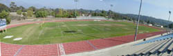
San Giordiano and Turnpike, North of
Hollister
Cal Track Cal Trax MS |
South |
8
100m
|
Aerial photo of the old track |
| Santa Barbara City College | 1998 | Yes | Adjustable Outside |
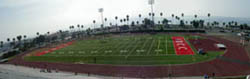
Cabrillo Blvd. at Loma Alta
Possbly the most beautiful stadium location in the world. The beach and harbor are immediately across the street. Decent night lighting. Due to prevailing wind they run sprints backward. Due to be resurfaced soon. They have installed a new fake grass infield and moved many of the field event runways in the process. The new fake grass prevents some events from being held there, particularly javelin. Since all events cannot be held, this stadium no longer qualifies to host the major events it had been known for. Editorial. ! Has enormous barricades that need a support pod on track. Some idiots have dragged the pod across the track which has left the most damage of anything. Southwestern Eurotan |
West |
9
90m
|
Aerial
photo
20 ft.
|
| Santa Barbara High School | Old | No | No |
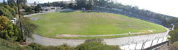
Anapamu and Olive
Essentially pavement, very little rubber. Wide turns, the stands arc around one turn as if for baseball (maybe decades ago) but no backstop. Stairs block the outside lanes. Rubber/Asphalt |
East Imperial |
6
55m
|
Aerial photo |
| University of California, Santa Barbara | Resurf. September 2003 | Yes | Adjustable Inside |
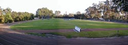
Just inside the West Entrance from Isla
Vista
The roots of the adjacent row of Eucalyptus trees creates a beautiful windbreak and shade, but also leave a mess of leaves on the track. The roots of those trees uprooted the previous track and a new one had to be installed. 9 lanes on sprint straight. |
Southeast |
8
99m
|
Aerial photo |
Santa Maria |
| Allen Hancock Junior College | Old | No | Stationary, Inside |
|
I spent 7 years training on the Santa Maria area tracks until the mid 80's. This was in terrible condition and I memorized every hole and crack. They resurfaced it since then, about the late 80's, noticibly improving the surface and converting this to metric (notice the extra lane in the first turn). Since then, the new surface has again worn away, the lane lines and finish line are invisible. The finish area is in the same condition as Cypress College with loose flecks of rubber coming off on your shoes. Terrible. As I photographed, the coach, Louie Quintana, was in the process of blowing off the loose rubber and painting new lane lines. He says there is a plan on the books to install a new track across College Dr. west of the track. Grass runway to steeplechase, other barriers in storage. Rubber/Asphalt |
East |
8
100m
|
Aerial photo |
| Righetti High School | Old | No | No |
|
Essentially all pavement. Has an incredible number of calibrated lines for cascading relay zones and various races on the imperial track with a 16m offset finish line. All the lines have been labeled. They once had a steeplechase pit with grass runway, but that has been removed. Asphalt |
East Imperial |
9
100m
|
Aerial photo |
| Santa Maria High School | Old | No | No |
|
Stowell and Thornburg
Essentially pavement with a thin layer of sealant, very little rubber. Very hard. 8 lanes for sprints. I'll guess this has been resurfaced because the lines have been repainted and labeled, but it does not look like it has changed much in 20 years. Cascading relay zones. Finish line offset 31m except for 300H. Rubber/Asphalt |
South Imperial |
7
100m
|
Aerial photo |
Santa Ynez |
| Santa Ynez High School | Old | Yes | No |
|
N. Refugio Rd. and Stadium Dr., North
of Hwy. 246 at first light west of town
Essentially all pavement, no sign of rubber. Spikes are useless here. Concrete curb. Hard to see red finish line here for some reason. Asphalt |
South Imperial |
8
82m
|
Aerial photo |
Cupertino |
| De Anza College | mid 80's | No | Stationary, Outside |
McClelland Road, South Entrance
I must comment on how uneven this surface is--on the homestretch, each lane line has a high point with a valley in between (though not as bad as I noted in previous comments--maybe they fixed it, maybe I was just sensitive at the time). The original hard Rubber Asphalt track dates to about 1970 but was resurfaced with new materials about mid-80's. There is almost one extra lane of the ancient surface around the outside of the track. There is also a dirt training lane inside the track that has been neglected. Adjustable steeplechase barriers around the track, but fenced water jump is stationary. Finish line offset 19m. |
South Imperial |
9
101m
|
Aerial photo |
| Homestead High School | 2001 | No | No |
Homestead and S. Mary, west of Stelling
Why/how did they construct a new track in the 21st century as an Imperial track? Why 7 lanes? 8 lanes for the sprint straight on backstretch where the chute is located, races run in reverse. Common finish marked with cascading relay zones. Finish line offset 5m. Cal Track Cal Trax MS |
East Imperial |
7
98m
|
Aerial photo when it was dirt |
Gilroy |
| Gilroy High School | Old | Yes | No |
|
W. 10th St. and Prinvevalle St.
Note: this is a rare case where you'll see a 440 track marked with cascading FINISH lines for metric races. Each of the sprints also finish on a different line (down the straightaway). You can feel many layers of paint on each marking (or maybe those have not worn down nearly as much as the rest of the track surface). Has a real concrete curb (though it may not be exactly 2" now, it still works). Rubber/Asphalt |
South, Imperial |
9
95m
|
Aerial photo |
Los Altos |
| Foothill Junior College | Resurf. Mid-80s |
No | No |
|
S. El Monte Ave, just west of the 280
exit (track is right next to the cloverleaf)
(dates to the late 60's but was resurfaced completely around mid-80's) This track is now in poor condition with wear spots in many places, the school let it run down after decimating the track program. The most obnoxious idiocy is the test well they drilled into lane 3 on the backstretch (and made no effort to repair). They have stored steeplechase barriers (fixed 36") but no sign of a water jump. |
North |
8
100m
|
Aerial photo |
| Los Altos High School | October 2003 |
No | No |
|
Almond Ave. 1 block east of San Antonio
Road
! Apparently fenced and locked at all times. SpectraTurf IMS |
North |
8
99m
|
Aerial photo |
Los Gatos |
| Los Gatos High School | mid-1970's | Yes | No |
 Behind
school off Los Gatos Blvd.,just east of Hwy. 17 exit. ! You can also enter
from the back of the motel parking lot though they apparently don't like people parking in the motel lot anymore--the
motel has posted nasty signs Wide turns here, looks like 75m. Has a warm
up lane inside of the curb but they store hurdles on it most of the time.
Behind
school off Los Gatos Blvd.,just east of Hwy. 17 exit. ! You can also enter
from the back of the motel parking lot though they apparently don't like people parking in the motel lot anymore--the
motel has posted nasty signs Wide turns here, looks like 75m. Has a warm
up lane inside of the curb but they store hurdles on it most of the time.
|
South, Imperial |
8
|
Aerial photo |
Milpitas |
| Milpitas High School | UC 2002 | No | No |
|
Camino Escuela
Under construction. Details not revealed. Cal Track Cal Trax MS |
North/South |
|
Aerial photo of dirt track |
Mountain View |
| Mountain View High School | October 2003 |
No | No |
|
S. El Monte Ave, just west of the 280 exit (track is
right next to the cloverleaf)
! Apparently fenced and locked at all times. SpectraTurf IMS |
North |
8
99m
|
Aerial photo |
| St. Francis High School | Yes | No | |
Miramonte Road
9 lanes on the sprint straight. West end of the track is dominated by a huge oak tree inside the track. Cal Track Cal Trax MS |
East |
7
93m
|
Aerial photo |
Palo Alto |
| Gunn High School | 2002 | No | No |
|
Arastradero and Foothill Expressway
When I saw it, admittedly during a rain storm, the chute was under water--this looked like it would be a long lasting puddle not just caused by the current rain. Poorly designed drainage. Cal Track Cal Trax MS |
South |
9
|
Aerial photo when it was dirt |
| Stanford University--Angel Field | 1996 | Yes | Adjustable, Inside |
 Embarcadero and Eucalyptus
This is the host of the National Championships. Track website link Why they built it finishing into the prevailing wind baffles me (I'm told it was for placement of the stands). ! has barricades and uses them. Southwestern Martin ISS |
West |
9
85.5m
|
Aerial photo |
| Stanford University--Stadium | mid 70's | Yes | No |

Embarcadero and Eucalyptus
440 yard banked track (with wide turns) like I've never seen anywhere else outdoors. Lane 6 would have a noticable net elevation loss from a 200 or 400 staggared start. ! The Stadium is now locked about sunset, use the gate on the east side. The person wide gap has been filled. I had heard a rumor that this track had been removed, or will be. It is in terrible shape but on my last visit, May 2003, it was still in place. The Steeplechase and other field event facilities have been removed. Finish line offset 5m. Tartan |
North, Imperial |
6
58m
|
Aerial photo |
San Jose |
| Archbishop Mitty High School | 1999 | No | No |
Lawrence Expressway at Mitty Drive
Cal Track Cal Trax MS |
East |
8
104m
|
Aerial photo |
| Bellarmine High School | No | No | |
|
Elm St., Heading St. under the bridge
at the railroad tracks
Blue. Cal Track Cal Trax MS |
East |
8
|
Aerial photo |
| Evergreen Valley High School | 2002 | No | No |
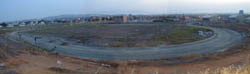
Quimby Road and Ruby Ave.
Under construction, May 2003. Details not revealed. Brand new High School being built Spectra Turf Spectratrack ISP |
|
Aerial photo of location |
| Independence High School | Resurf. 2001 |
Yes | No |
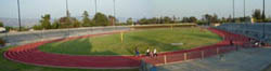
Jackson north of McKee
Dates to the 80's Cal Track Cal Trax MS |
South |
8
95m
|
Aerial photo |
| Mt. Pleasant High School | 2003 | No | No |
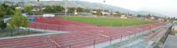
White Road and Marten Ave., go east
Recently finished, stadium construction still going on in May 2003 Cal Track Cal Trax IMS |
South |
8
99m
|
Aerial photo of dirt track |
| Overfelt High School | 2002 | No | No |
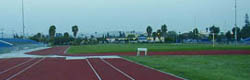
Ocala Ave. and Winterpark Way, East
of King Road, West of Reid/Hillview Airport
! Spike fencing makes getting in harder. Yellow lane lines--Mt. Pleasant is just up the street. Cal Track Cal Trax IMS |
Southeast |
8
98m
|
Aerial photo of dirt track |
| San Jose City College | Redone. 2001 |
Yes | Adjustable, Inside Slice |

Moorpark and Leigh
Blue striped. Dates to the late 60's but has been resurfaced many times. This is still looking to aspire to be a first rate facility (with the same aluminum stands from the late 60's). When the most recent renovation to Mondo occurred, they also added a fake grass infield (watch those football knee injuries increase--the orthopedic surgeons at the hospital across the streeet must be licking their chops). Lots of first class field event facilities as well. Mondo |
East |
8
100m
|
Aerial photo |
| San Jose P.A.L. Stadium | Yes | No | |
 34th and Virginia, near 680 and King Road
This is the worst maintained all-weather facility I've ever seen. This is worse than a dirt track--the surface is almost unrecognizable. The original surface didn't look to be much more than painted pavement to begin with (I didn't notice any rubbery feel to the chipped away surface). This has been so neglected that much of the straightaways have gone through to dirt. This is now a dangerous mix of dirt, mud holes and disintegrating pavement. !And its protected by barb wire fences. Don't even bother to go here, go to Independence, Silver Creek, Mt. Pleasant, Overfelt or SJSU nearby. |
Once was west | No longer marked | Aerial photo |
| San Jose State University | vintage 1960's | No | No, removed |
Green. I just noticed the curb (and bleachers) have been removed. The track (one of the first All Weather tracks around) is still there, but for how long? Apparently they want to put in a parking lot. Actually they already have, with lines painted on the track and dirt to park cars there. The track bubbled even in the old days, but it is now worse. No maintenence has been done in decades. Some pieces are now missing, runways are overgrown. They even have the original cascading metric finish lines from the original painting. Tartan |
South Imperial |
9
100m
|
Aerial photo |
| Silver Creek High School | 1999 | No | No |
|
Daniel Maloney Dr. and Brigadoon Way,
just east of Silver Creek R.south of Capitol Expressway
The inner curb doesn't qualify because it raises the track. Southwestern Eurotan |
South |
8
99m
|
Aerial photo |
| Valley Christian High School | May 2001 | No | No |
|
100 Skyway east of Monterey Hwy.--on
top of the hill
Blue. Another one with new fake grass infield. Already has been repainted to either cover repairs or vandalism. |
South |
7
|
Aerial photo of construction |
Santa Clara |
| Santa Clara High School (formerly Buchser High School) | 2000 | No | No |
|
Benton just west of Kiley
Cal Track Cal Trax MS |
South |
8
|
Aerial photo of construction |
Saratoga |
| Saratoga High School | 1998 | No | No |
| Herriman Ave. east of Saratoga-Sunnyvale
Road
9 lanes on sprint straight |
South |
8
102m
|
Aerial photo |
| West Valley Junior College | (No) | Adjustable, Slice | |
 South exit off Fruitvale Road south
of Allendale South exit off Fruitvale Road south
of AllendaleDates back to 1974 (resurfaced/modified at least twice since then). It is now Blue. They once had a curb but took it out. It is inexplicable why the outside curb still exists, but the inside curb was removed and sits in a pile on a pallet at the head of the chute. This stadium has no seating or lights (and apparently never will due to neighborhood objections), so it wouldn't have been used for graduation. Note: the tenth lane on the first turn, a result of the shortening of the track from imperial to metric. It is curious they have only marked 4x400 relay zones in the first 5 lanes. |
South |
9
100m
|
Aerial photo |
Aptos |
| Aptos High School | 2002 | No | |

Freedom Blvd and Mariner Way
Blue |
Southeast |
8
|
Aerial photo |
Soquel |
| Soquel High School | 1997 | Yes | Not really but |
|
San Jose-Soquel Road
Yes, a legal curb at a new high school track--amazing. They also had steeplechase barriers but no water jump. Instead they placed a barrier next to the long jump put. Southwestern Eurotan |
Southeast |
9
|
Aerial photo |
Cottonwood |
| West Valley High School | Yes | No | |
 Happy
Valley Road, north of Gas Point Rd. Southwest of town Happy
Valley Road, north of Gas Point Rd. Southwest of townThey actually have a proper metal curb. Finish line offset 10m. |
8
99m
|
Map |
Redding |
| Enterprise High School |
2000 |
No | No |
 Churn
Creek Road Churn
Creek RoadBlack. Finish line offset 10m |
8
|
Map |
| Shasta College | Yes | No | |
|
8
|
Map |
| Shasta High School |
2002 |
No | No |
|
8
|
Map |
Weed |
| College of the Siskiyous | Old | No | No |
|
College Ave. west of the 5/97 interchange
Rubber/Asphalt |
8
|
Map |
Yreka |
| Yreka High School | Old | No | No |
|
Knapp St., 1 block west of Oregon St.
Rubber/Asphalt |
|
Map |
Fairfield |
| Fairfield High School | 1996 | No | No |
|
Atlantic, 1 block west of Dover, just
north of Air Base Parkway
Look at the length of that sprint straightaway. Southwestern |
North |
|
Aerial photo |
Suisun City |
| Solano Community College | Old | No | No |
|
In terrible condition. Hard surface, worn to powder, very inconsistent. Lane lines obliterated in many places. Curb overgrown with weeds. Soccer benches and garbage cans litter lane 1 (obviously not used for competition). When I visited this was one of the windiest locations I've ever experienced. I am told this is normal. Considering the wind conditions, without constructing a huge wall this probably isn't worth salvaging. Finish line offset 20m. Rubber Asphalt |
South Imperial |
9
100m
|
Aerial photo |
Travis Air Force Base |
| Vanden High School | No | No | |
|
Markley Lane, west of Peabody Rd.
Offset finish, looks imperial from afar |
South |
8
|
Aerial photo |
Vallejo |
| Vallejo High School | No | No | |
|
Nebraska and Broadway
Stadium is called Corbus Field. |
South |
|
Aerial photo |
Petaluma |
| Petaluma High School | Yes | No | |
 Fair Street where it turns into 10th Street at Douglas
Street
Fair Street where it turns into 10th Street at Douglas
StreetHas a fake grass infield in the stadium. |
Southeast |
8 |
Aerial photo |
Rohnert Park |
| California State University, Sonoma | Yes Inside | ||
|
Cotati Ave. at the east end where it
meets Petaluma Hill Rd.
|
South |
|
Aerial photo |
Santa Rosa |
| Elsie Allen High School | No | No | |
|
Bellevue Ave. and Stony Point Road
|
North |
|
Aerial photo |
| Cardinal Newman High School |
UC 2002 |
Yes | No |
|
Ursuline Road and Old Redwood Highway,
just south of Mark West Springs Road
Cal Track Cal Trax MS |
North/South |
6
|
Aerial photo of dirt track |
| Santa Rosa City College | Resurf. 2001 |
No |
Yes inside |
| Mendocino and Pacific
Cal Track Cal Trax MS |
South |
8 |
Aerial photo |
Sebastpol |
| Analy High School | No | No | |
 Johnson St. and Sunset Ave.
Black |
West |
8 |
Aerial photo |
Sonoma |
| Sonoma Valley High School |
1988 |
No | No |
|
Broadway and E. MacArthur
Black. This looks like it might be an old Rubber Asphalt |
East |
7 |
Aerial photo |
Modesto |
| Modesto Junior College | Yes | Adjustable, Inside | |

Tully Road and Coldwell
Home of the famous Modesto Relays. Tight turns. In order to put the finish in front of the fans in the stands; Finish line is offset 19m. Steeplechase finishes in reverse. Southwestern Eurotan |
South |
9110m
|
Aerial photo |
Turlock |
| California State University, Stanislaus |
No |
Adjustable, Inside | |
|
Monte Vista and Geer
Has a curb all the way around the track, but it never reaches the 5 cm required and dips below the track surface in some places. |
South |
9
100m
|
Aerial photo |
Porterville |
| Porterville Community College | No | Yes, Outside | |
|
College & Main, south of Highway 190
|
South |
|
Black and White Aerial photo |
Tulare |
| Tulare High School (Bob Mathias Stadium) | mid 80's | Yes | No |

Tulare Ave. and Cherry
Black Concrete curb. Finish line offset 10m. |
South Imperial |
9
100m
|
Black and White Aerial photo |
Visalia |
| College of the Sequoias | late 60's or early 70's | No | No |
|
Woodland & Meadow
The four lane track is the narrowest track intended for competition in the state. Tartan |
North Imperial |
4
|
Black and White Aerial photo |
| Redwood High School | 1991 | Yes | I think there is one here |
|
Mineral King and Conyer
|
East |
9
|
Black and White Aerial photo |
Camarillo |
| Camarillo High School | Resurf.
Aug. 2002 |
No | No |
 West entrance off Mission Oaks Blvd.
Blue. There is no explanation for why this was constructed in the '80s with the chute on the wrong side of the track. With no consideration for automatic timing (which the school now owns), this school runs sprints and short hurdles backwards on the backstretch (finish line offset 30 yards/27.42m from the 300m start line/break line). It has just been resurfaced and enough of a chute was installed to allow hurdles to be run on the home stretch. But to my surprise, they did not mark the home stretch for 110HH. Instead there is a start line 112.75m before the finish line (about 9 feet longer than it should be, obviously there is room for a proper start line) and no hurdle marks for 110H. But there are girls 100H marks on that straightaway (meaning just the one race HAS to be run on the backstretch). All I can do is shake my head. This used to have a 10m offset finish line but no longer. They also added a new tall fence to protect the backstretch sprint chute (that they really shouldn't use) from exceptionally long, foul home runs from the nearby baseball field. Note: Steroids are not illegal in Major League Baseball and now every high school player knows the big guys are using so . . . ! has barricades and uses them occasionaly. Southwestern Seal Flex |
East |
9
100m
|
Aerial photo |
Moorpark |
| Moorpark High School | 1996 | No | No |
 Tierra Rejada opposite Countrywood Dr.
Take the roadway to the park. Tierra Rejada opposite Countrywood Dr.
Take the roadway to the park.! The fencing here makes it quite difficult to get into--the north entrance is not as high as the south or west entrances. |
East |
9
100m
|
Aerial photo |
Oxnard |
| Channel Islands High School | 1993 | No | No |
 Rose and Gary, 2 blocks south of Channel Islands
Straightaway also marked to run hurdles and sprints in reverse, using the same hurdle marks (meaning there is an extra start and finish line for each race). Southwestern Seal Flex |
West |
8
100m
|
Aerial photo |
| Oxnard High School | 1999 | Yes | No |
Gonzales between Patterson and Victoria
Yes, a legal concrete curb at a new high school track--amazing. There is no explanation for why this was constructed with the chute on the wrong side of the track. With no consideration for automatic timing, this school runs sprints and short hurdles backwards on the backstretch. In fact, all short hurdle marks only appear on the backstrech. They must have used the older Camarillo track as an example. This track now has some repairs and ugly water stains on it. Southwestern |
East |
9
100m
|
Aerial photo |
| Pacifica High School | September 2001 |
No | No |
Gonzales east of Oxnard Blvd.
There is an extra 2 foot wide tenth lane all the way around the track with no calibrated lines. There is also a strange wide section, with no purpose, on the east end of the homestretch, ending in a downhill section. Southwestern Seal Flex |
East |
9
91m
|
Aerial photo of location before construction |
| Rio Mesa High School | Resurf. 2001 |
No | No |
 Rose and Central Rose and CentralBlack. This is not 400 meters or 440 yards, they mismeasured when it was built and the markings are calibrated to compensate for the error (it is approx. 2 feet longer than 400 meters--my guess is someone built the track level concrete curb as an exact 400 meters, not planning on the 20cm or 30cm measurement point). It was recently resurfaced--but the measurement error was not fixed. In fact, the start lines are now in a slightly different location, offset about 2m and I can find no mathematical explanation for why they are not symetrical--I suspect yet another error. I measured them and determined the 800 line is about 2 feet too close to the finish line. Here's a photo. I also don't see anyone taking credit for this track originally built in 1986 but the resurfacing done by Southwest in 2001 was so thin the lines and other painted sections from the previous surface are already showing through all over the track. |
East Non-standard |
9
100m
|
Aerial photo |
Port Hueneme |
| Hueneme High School | 2000 | No | No |
C Street and Van Ness Ave.
There is an extra lane on the home straight and first turn. This is not exactly from an imperial conversion, but more to fill in the gap to the previous fence built around the original dirt imperial track. ! This school likes fences, so there are several to traverse including double barb wire on the street sides of the track. Southwestern Eurotan |
East |
9 100m
|
Aerial photo |
Simi Valley |
| Royal High School | 1997 | No | No |
Arcane St. and Hudspeth Ave. enter off
Royal Ave. east of Pride St.
This is a classic example of the flattened turn or broken back style of track. The widest turns I've seen on a good track, less than 80m straightaways. Unlike other odd tracks, I can see no reason why they had to construct the track in this fashion. Southwestern Eurotan |
West |
9
|
Aerial photo |
Thousand Oaks see also Agoura and Westlake Village in Los Angeles County |
| Thousand Oaks High School | June 2001 | No | No |
|
Avenida de las Flores and N. Moorpark
Road
Cal Track Cal Trax IMS |
East |
9
99m
|
Aerial
photo of dirt track
800 ft.
|
Ventura |
| Buena High School | UC June 2003 | No | No |
Wake Forest south of Telegraph |
|
Aerial photo of dirt track |
| Ventura High School | November 2003 |
No | No |
 .Poli
St. one block west of Seaward .Poli
St. one block west of SeawardOh, the stories I hear. At one point in time the local architect (who apparently knows nothing about track) had a 404 meter track on the books. Fortunately that was prevented but this is what you get when you leave a track project up to local construction people. What we do have is a track banked for drainage, with a slight hill near the end of the north straight. The installer made numerous other corrections to keep up with the inconsistent curb height and uneven (by track standards) subsurface. "Its the worst planarity I've seen in a long time" said one of the installers. Sprints run backward on the north straight (with chute), not even marked on the side with the common finish. Finish line offset 10m. Cal Tracks Rekortan Imbeded |
East |
9
99m
|
Aerial photo of dirt track |
Davis |
| University of California, Davis | Yes | Yes | |
 Russell and A Street Russell and A Street |
South |
8
|
Aerial photo |
Yuba City |
| Yuba Community College | Yes | ||
|
N. Beale Street and Alberta Ave.
|
8
|
Map |
Fallon |
| Churchill High School | 1995 | No | No |
|
Taylor and Front
These Northern Nevada aerial photos are very hard to read--this looks like dirt. Southwestern Seal Flex |
East West |
8
|
Black & White Aerial photo |
Boulder City |
| Boulder City High School | 1998 | No | No |

6th and Avenue B
Black Southwestern Seal Flex |
South |
8
|
Aerial photo |
Henderson |
| Basic High School | 1998 | No | No |
|
Palo Verde and Dooley
Black Southwestern Seal Flex |
South |
8
|
Aerial photo |
| Coronado High School | 2000 | No | No |
|
Coronado Center, South of Eastern and
St. Rose
Black. Wide turns Southwestern Seal Flex |
North |
8
85m
|
Aerial photo of location |
| Green Valley High School | Resurf. 1998 |
No | No |
|
Arroyo Grande between Sunset and Warm
Springs
Black. Originally installed in 1990 Southwestern Seal Flex |
West |
8
|
Aerial photo |
| Foothill High School | No | No | |

College at the 515 Freeway exit
Black. Wide Turns Southwestern Seal Flex |
South |
8
85m
|
Aerial photo |
Indian Springs |
| Indian Springs High School | 1998 | No | No |
|
Southwestern Seal Flex
|
8
|
Las Vegas |
| Bonanza High School | 1998 | No | No |
|
Torrey Pines and Oakey
Black Southwestern Seal Flex |
South |
8
|
Aerial photo |
| Centennial High School | 1999 | No | No |
|
way West on Centennial Parkway in the
far north end of what will be town
Black Southwestern Seal Flex |
South |
8
|
Aerial photo |
| Clark High School | 1998 | No | No |
|
Wynn and Sirius
Black. Broken back track with 115 m straightaway Southwestern Seal Flex |
South |
8
|
Aerial photo |
| Chaparall High School | 1998 | No | No |
|
Twain at the 515 underpass
Black. Broken back track with 115 m straightaway Southwestern Seal Flex |
South |
8
|
Aerial photo |
| Cimmaron Memorial High School | Resurf. 1998 |
No | No |
|
Tenaya North of Lake Mead
Black. Originally installed in 1990 Southwestern Seal Flex |
North |
8
|
Aerial photo |
| Desert Pines High School | 1999 | No | No |
|
Harris and Sandhill
Black Southwestern Seal Flex |
South |
8
|
Aerial photo |
| Durango High School | Resurf. 1999 |
No | No |
|
Dewey west of Rainbow
Black. Originally installed in 1992 Southwestern Seal Flex |
South |
8
|
Aerial photo |
| El Dorado High School | Resurf. 1999 |
No | No |
|
Harris and Christy
Black. Originally installed in 1990 Southwestern Seal Flex |
South |
8
|
Aerial photo |
| Faith Lutheran High School | 1999 | No | No |
|
Hualapai north of Charleston--far west
end of Las Vegas as Charleston goes out of town
Black. A private school with a track. Inside concrete curb elevates the track. Southwestern Seal Flex |
South |
8
|
Aerial photo |
| Las Vegas High School | No | No | |
|
Sahara and Hollywood--the far east end
of Sahara
Black. Wide Turns Southwestern Seal Flex |
South |
8
85m
|
Aerial photo |
| The Meadows School | No | No | |

N. Rampart Blvd. opposite Hillpointe
Rd. just north of Summerlin Parkway
Black. Another private school with a track. Here the lane lines alternate colors between blue and white. Southwestern Seal Flex |
South |
8
100m
|
Aerial photo |
| Palo Verde High School | 1997 | No | No |

Pavilion Center and Alta--far west side
Black. I have never seen this place when it isn't windy Southwestern Seal Flex |
North |
8
|
Aerial photo |
| Rancho High School | 1998 | No | No |
|
21st and Searlies
Black. Broken back track with 115 m straightaway Southwestern Seal Flex |
South |
8
|
Aerial photo |
| Silverado High School | 1999 | No | No |

SW Corner of 215 and Spencer
Black. Wide Turns Southwestern Seal Flex |
South |
8
85m
|
Aerial photo |
| Sierra Vista High School | 2001 | No | No |
|
Robindale--currently a high school in
the middle of nowhere, surrounded by desert.
Southwestern area. The way Las Vegas grows, this will be the center of town in a couple of years. With Black. Wide Turns Southwestern Seal Flex |
South |
8
85m
|
Aerial photo of construction |
| University of Nevada, Las Vegas | 1998 | Yes | Yes, inside |
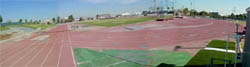 Swenson
and Harmon, a block from the Hard Rock Hotel Swenson
and Harmon, a block from the Hard Rock HotelFor tourists, this is the closest to "The Strip." They moved the track about 200 yards south east of its original location. This is the only track in town that is fenced and locked during the evening hours when it is most practical to run. I've noticed many (I assume to be locals) just jump the fence. When I saw it last, the inside removable Steeplechase was removed (actually there is no barrier at the water jump, instead just a 36" barrier. In fact all are 36" and are placed around the water pit. Oh, that liability paranoia. That is curious since UNLV only has a Women's track team. Southwestern Martin ISS |
South |
9
|
Aerial photo |
| Valley High School | 1998 | No | No |
|
Karen and Eastern
Black Southwestern Seal Flex |
East |
8
|
Aerial photo |
| Western High School | 1998 | No | No |
|
Bonanza and Decatur--north of the Decatur
exit off the 93
Broken back track with 115 m straightaway Southwestern Seal Flex |
South |
8
|
Aerial photo |
Laughlin |
| Laughlin High School | 1999 | No | No |
|
Cougar Drive and Spirit Lane
Black. Up the hill out of town. This is way out of town in the middle of the desert. But then the whole town is a little spot of casinos along the river in the desert. Southwestern Seal Flex |
South |
8
|
Aerial photo |
Logandale |
| Moapa Valley High School | Resurf. 1999 |
No | No |
|
Originally installed in 1992
Black Southwestern Seal Flex |
South |
8
|
Mesquite |
| Virgin Valley High School | Resurf. 1999 |
No | No |
|
Originally installed in 1990
Southwestern Seal Flex |
South |
8
|
North Las Vegas |
| Cheyenne High School | Resurf. 1998 |
No | No |
|
Harris and Christy
Black. Originally installed in 1990 Southwestern Seal Flex |
South |
8
|
Aerial photo |
| Community College of Southern Nevada | No | No | |
|
Colton and Pecos
Black. Lit frequently at night Southwestern Seal Flex |
South |
8
|
Aerial photo |
| Mojave High School | 1997 | No | No |
|
N. 5th and E. Washburn
Black. Originally installed in 1990 Wide Turns Southwestern Seal Flex |
South |
8
|
Aerial photo |
Carson City |
| Carson City High School | 1992 | Yes | No |

Black with a concrete curb
Southwestern Seal Flex |
9
|
Aerial photo |
Elko |
| Elko High School | Resurf. 2003 |
No | No |
|
Originall built in 1996
Southwestern Seal Flex |
|
Map |
Yerington |
| Yerrington High School | No | No | |
|
Pearl and Oregon St (1 block east of
95 and Main St.)
Photo looks like a dirt track? Southwestern Seal Flex |
South |
8
|
Black & White Aerial photo |
Reno |
| Reno High School | No | No | |
|
Idlewilde Dr. and Hunter Lake Dr..
Southwestern Eurotan |
|
Bad Black & White Aerial photo |
| University of Nevada | 1989 | Yes | Yes, inside |
|
15th Street and N. Virginia St.
The photo is so hard to read I can't tell if this is the track. Southwestern Eurotan |
|
Bad Black & White Aerial photo |
Sparks |
| Reed High School | No | No | |
|
Sparks Blvd. and Baring Blvd.
|
South |
|
Bad Black & White Aerial photo |
| Sparks High School | No | No | |
|
15th Street and Oddie Blvd.
Southwestern Eurotan |
|
Bad Black & White Aerial photo |
| Arlington High School, Riverside | (repeat offender) |
| Bellflower High School | (multiple repeat offender) When visited them again it still had a huge puddle. More recently during track season they had improved a little, but there was not a single lane on the track that was not muddy from the sprinklers the night before. Those same sprinklers were just starting up that night and had not yet reached the track when I saw them. |
| Belmont High School, Los Angeles | (multiple repeat offender) Worse than my last visit--apparently flooding on this track is so common, neighborhood joggers use plywood bridges to step over the immense flood zones. Even during track season--during a track meet, they had dried it out but the damage was beyond repair. |
| Bishop Montgomery, Torrance | (repeat offender) Always puddles in lane 1 |
| Bonita Vista High School, Chula Vista | |
Chatsworth High School, Los Angeles |
|
| Crespi Carmelite High School, Encino | (repeat offender) Better, but still showed signs of repeated damage. |
| Damien High School | Their lawnmower must be possessed, they sprayed lawn clippings so much it burried the inner two lanes of the track, no curb was visible anywhere. |
| Eagle Rock High School, Los Angeles | Managed to have lane 1 under water the entire circumference when I visited. |
| Fairfax High School, Los Angeles | Several spots of full width flooding |
| Francis Poly High School, Los Angeles | Three spots of full width flooding |
| Frazier Mountain High School, Gorman | A relatively new high school, so obviously the facilities are also relatively new. I will concede they have snow at this elevation for portions of the year. That does not excuse letting the weeds grow across several lanes. The garbage cans and soccer benches look like a permanent fixture on the track. I can only assume the puddles to be part of the regular mess that I saw mid-summer. |
| John Glenn High School, Norwalk | (repeat offender) Was flooded, under water the full width when I visited it the first time, it was better the next time but still is poorly cared-for despite being locked behind two fences. During track season it was better but still showed signs of the damage. |
| Katella High School | One whole end of the track was flooded full width. |
| La Canada High School | (repeat offender) Better, but still had a big puddle. It was horrible on a previous visit. |
| Lompoc High School | (repeat offender) This is the worst example of both problems: When I saw it last, the sprinklers were watering just the track (turning it into a mud bog). They were so screwed up they missed the grass completely. Of course, nobody could get in there to do anything about it, the track is surrounded by a 12 foot barb wire fence. While I was there, I asked around. Apparently they were flooding the football field during the winter rains, to solve that (rather than just changing the sprinkler programming) they turn the sprinklers onto the track deliberately to keep the excess water off the football field. |
| L.A. Harbor College | (multiple repeat offender) After ruining the length of their track--see below, they apparently don't care about flooding it, large portions were mud. |
| Monrovia High School | Apparently a perrenial huge puddle on the north turn. They dried it out during track season but the residual damage was still noticible. |
Mt. Carmel High School, San Diego |
(repeat offender) |
North High School, Riverside |
A big puddle in lane 1 during track season. I also have to wonder about a place that has marked, staggered relay passing zones on the home stretch--trackos think about it. And these were the State Champions. |
| Norwalk High School | They use the track to dump their yard waste. |
Ramona High School, Riverside |
Big fences protect a poorly attended-to track. |
| San Dimas High School | Used to be a nice place now trenched from excessive water runoff. |
Santiago High School, Garden Grove |
Baseball is the sport here. In addition to flooding the track, they store their baseball bleachers on the track. |
| Tustin High School | Lots of mud and bicycle tracks hardened into what was recently mud. |
| Villa Park High School | Repeat offender, my most recent visit showed the signs of six separate flood zones, several that cross the entire track. |
| Las Vegas Academy (downtown Las Vegas) | has a short track that goes under the corner of a building. Its also one only two dirt tracks in town (see also the other Las Vegas notes above) |
| Rancho San Antonio (Boys School) | apparently used to have a proper length 2 lane track but they built a fence in the way and diverted the track the long way around through two openings in the fence Its hard to see what I mean here but the track goes south of the tree line on the south side of the picture. There is a right turn to get there (the gap at the south end) and another right turn to get back into the north turn. |
| Loma Linda University | has a two lane dirt path, marked by rocks as a poor excuse for a running track (it used to be about 400m, but has been shortened to make more room for a soccer field) |
| Pt. Mugu Naval Air Station | has a half mile track that has an internal cut off for a quarter mile distance |
| Flamson Junior High School (formerly Paso Robles High School) in Paso Robles | paved over the track and made it a still runable path around the fenced football field. |
| Emery High School (San Pablo Ave. and 47th St.) in Emeryville | You have got to see the shape of this one. This is an all-weather track with a right turn and an odd angle in it, I kid you not. See what I mean Additional notes above. |
| Bishop Montgomery High School, Torrance | has just over half a track, one turn, one straightaway, part of a curve with the theoretical remainder of the curve passing through the dirt infield of the baseball field. The other straightaway cuts across the right field grass. See what I mean. |
| Campbell Hall in Studio City | is similar, it has one turn, one overly long straightaway (paralell to the left field line), half of another straightaway that stops and runs off into the grass of right field of their baseball diamond. No indication of how the other turn works through the outfield but it is definitely long to return to the beginning of the straightaway. A finish line in center field would almost make a one-turn 440. See what I mean. |
| Orange Lutheran High School, Orange | apparently once had a 300 meter track. They tore up more than half of it replacing it with a wider parking lot that slopes into where the track used to be. They also paved over one straightaway for no apparent reason, but left one turn and most of the other straightaway along with the markers to show where the start and finish lines used to be. Its hard to see what I mean, but here it is. |
Woodbury University, Burbank |
once had a track--3/4 of the remnants remain neglected, minus the curb. They tore out the curb and one end of the track to build tennis courts and to make the field better for soccer. This is a private college so this isn't as much a community resource destroyed. I just can't see why they couldn't have moved the new construction a few yards north of the track and left the facility rather than destroying it. See what I mean. |
| Golden Gate Park Polo Field, San Francisco | had a large track around the grounds, with a smaller quarter mile dirt running track with chutes on the opposite axis inside. |
| 1. | San Jose P.A.L. Stadium | The is in such bad condition the surface was unrecognizable. Most of the all-weather surface (that wasn't much more than painted asphalt to begin with--I can't feel any rubber in the pieces that chip away, the only soft part was the thin layer of paint) has been broken through so it is a mess of mud and broken pavement. Unsafe, unusable. |
| 2. | Palomar College, San Marcos | Worn out so most lane lines are invisible. Lane one is down to pavement. Lane two and part of lane three (which has a seam about a foot into the lane) are relatively thin though worn rubber asphalt and the outer lanes apparently older surface is badly cracked. They are aware of the problems, signs warn of the danger and paint marks some of the problem spots. |
| 3. | Cypress College | Most of the lane lines are worn off. Little cunks of rubber come off on your shoes. Several places are worn through to pavement. |
| 4. | Solano Community College, Suisun City | Badly neglected, the surface has disintegrated into powder in many spots around the track. The inner lane (with soccer benches and garbage cans) is overgrown with weeds. Lane lines imperceptible in many sections of the track. |
| 5. | Allen Hancock College, Santa Maria | They resurfaced it in the mid 90's. Since then, the new surface has again worn away, the lane lines and finish line are invisible. The finish area is in the same condition as Cypress College with loose flecks of rubber coming off on your shoes. |
| 6. | Southwestern College, Chula Vista | The inner lane lines have disappeared. Outer lane lines are slowly fading. A 50 yard section of the backstretch is missing all lane lines, obviously from being flooded every night. |
| 7. | Golden West College | Many places are worn out like Cypress. Its only lower on the list because ALL of the track isn't in that bad of condition. |
| 8. | Cordova High School | Bad repairs with asphalt showing through (particularly in lane one) in the North turn . Also subject to a constant puddle in the South turn. They might be redoing this track now, I can't reach anybody there. |
| 9. | Righetti High School, Santa Maria | A Rubber Asphalt track. The old, original rubberized surface has worn through to the pavement below. |
| 10. |
San Jose State University |
This was one of the first and one of the best All-Weather tracks in the world. Due to outright aggressive destruction (well beyond accidental damage), this great track barely survives its hostile environment--the attitude of the management of this facility (my Alma Mater). They treat it as though it is a nuisance. Not only do they use it as a parking lot, these idiots have painted parking lines on the Tartan track surface. Sections have been plowed by heavy equipment, some portions are just plain missing. Runways have overgrown, the curb, bleachers and other field event facilities have been removed. But still the now over 35 year-old track survives despite the abuse it is getting-a good reference for the Tartan process. |
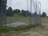
 Old Oregon Trail and Collyer just north of 299 exit
 Eureka
Way (Highway 299) and Walnut Ave
Eureka
Way (Highway 299) and Walnut Ave